Miyako, Iwate
|
Miyako 宮古市 |
|||
|---|---|---|---|
| City | |||

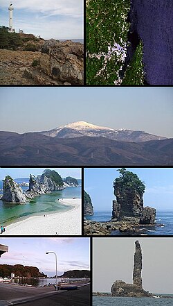
Top left: Cape of Dodo and lighthouse, Top right: Miyako Bay from satellite, 2nd row: Mount Hayachine, lower left: Jyodo Beach, lower right: Rock of Sano, Bottom left: Tago Port, Bottom right: Rock of Rosoku (Candle)
|
|||
|
|||
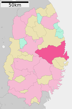
 Location of Miyako in Iwate Prefecture |
|||
| Coordinates: 39°38′29.1″N 141°57′25.7″E / 39.641417°N 141.957139°ECoordinates: 39°38′29.1″N 141°57′25.7″E / 39.641417°N 141.957139°E | |||
| Country | Japan | ||
| Region | Tōhoku | ||
| Prefecture | Iwate | ||
| Area | |||
| • Total | 1,259.15 km2 (486.16 sq mi) | ||
| Population (September 2015) | |||
| • Total | 55,041 | ||
| • Density | 43.7/km2 (113/sq mi) | ||
| Time zone | Japan Standard Time (UTC+9) | ||
| City symbols | |||
| - Tree | Japanese red pine | ||
| - Flower | Montauk daisy (Nipponanthemum nipponicum) | ||
| - Bird | Black-tailed gull | ||
| - Fish | Chum salmon | ||
| Phone number | 0193-62-2111 | ||
| Address | 2-1 Shinkawachō, Miyako-shi, Iwate-ken 027-8501 | ||
| Website | Official website | ||
Miyako (宮古市 Miyako-shi?) is a city located in Iwate Prefecture, in the Tohoku region of northern Japan. As of September 2015, the city had an estimated population of 55,041 and a population density of 43.7 persons per km2. The total area was 1,259.15 square kilometres (486.16 sq mi).
Miyako is located in central Iwate Prefecture, bordered by the Pacific Ocean to the east, where the Hei River (閉伊川 Heigawa?) flows into Miyako Bay. It is connected to Morioka by an east-west train line and highway and the coastal highway also goes through the town. The city has a small port but much of the shipping traffic is taken by larger cities along the coast. Parts of the coastal area of the city are within the borders of the Sanriku Fukkō National Park. The easternmost point of Honshu island is at Cape Todo (魹ヶ崎 Todogasaki?) in Miyako.
...
Wikipedia


