Mirny, Arkhangelsk Oblast
| Mirny (English) Мирный (Russian) |
|
|---|---|
| - Town - | |
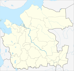
 Location of Arkhangelsk Oblast in Russia |
|
|
|
|
|
|
|
|
|
|
| Administrative status (as of June 2013) | |
| Country | Russia |
| Federal subject | Arkhangelsk Oblast |
| Administratively subordinated to | town of oblast significance of Mirny |
| Administrative center of | town of oblast significance of Mirny |
| Municipal status (as of April 2014) | |
| Urban okrug | Mirny Urban Okrug |
| Administrative center of | Mirny Urban Okrug |
| Representative body | Council of Town's Deputies |
| Statistics | |
| Population (2010 Census) | 30,280 inhabitants |
| Time zone | MSK (UTC+03:00) |
| Founded | November 23, 1960 |
| Town status since | February 2, 1966 |
| Postal code(s) | 164170-164173, 164182–164184, 164188 |
| Dialing code(s) | +7 81834 |
|
|
|
| on | |
Mirny (Russian: Мирный; IPA: [ˈmʲirnɨj], lit. peaceful) is a closed town in the west of Arkhangelsk Oblast, Russia, serving the Plesetsk Cosmodrome. The town is located 9 kilometers (5.6 mi) from the urban-type settlement of Plesetsk and is connected to it by a road and a railway. Gorodskaya railway station is located within the town, being a terminus to cosmodrome's vast railway system. The Plestsy Airport is also located nearby. Population: 30,280 (2010 Census);30,502 (2002 Census).
The area administered by the town borders with Kholmogorsky District in the north, Vinogradovsky District in the east, and Plesetsky District in the south and in the west. The area is elongated from the east to the west and is approximately 50 kilometers (31 mi) long and 20 kilometers (12 mi) wide. The town proper is located in the extreme southwestern end of the area. The Yemtsa River flows in the north of the area, whereas the Mekhrenga River crosses it south to north in the eastern part. The whole area belongs to the Northern Dvina River basin. Except for the military installations, it is covered by coniferous forest (taiga).
In 1957, an area for the settlement for ballistic missile launch site workers was designated. In 1958, the population of the area, about 4,000, was resettled; the same year the construction started. On November 23, 1960 the settlement of Mirny was established. In 1966, with the development of the cosmodrome, it was designated a closed town. Mirny was never mentioned in the media before 1983.
...
Wikipedia


