Minong, Wisconsin
| Minong, Wisconsin | |
|---|---|
| Village | |
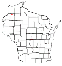
 Location of Minong, Wisconsin |
|
| Coordinates: 46°6′59″N 91°55′5″W / 46.11639°N 91.91806°WCoordinates: 46°6′59″N 91°55′5″W / 46.11639°N 91.91806°W | |
| Country | United States |
| State | Wisconsin |
| County | Washburn |
| Area | |
| • Total | 1.50 sq mi (3.88 km2) |
| • Land | 1.49 sq mi (3.86 km2) |
| • Water | 0.01 sq mi (0.03 km2) |
| Elevation | 1,056 ft (322 m) |
| Population (2010) | |
| • Total | 527 |
| • Estimate (2012) | 521 |
| • Density | 353.7/sq mi (136.6/km2) |
| Time zone | Central (CST) (UTC-6) |
| • Summer (DST) | CDT (UTC-5) |
| Area code(s) | 715 & 534 |
| FIPS code | 55-53275 |
| GNIS feature ID | 1583729 |
Minong is a village in Washburn County, Wisconsin, United States. The population was 527 at the 2010 census. The village is located within the Town of Minong.
Minong is a name derived from the Ojibwe language, perhaps meaning "good place" or "blueberry place". A post office called Minong has been in operation since 1887. The village was laid out in 1888.
U.S. Highway 53 and Wisconsin Highway 77 are two of the main routes in the community.
Minong is located at 46°5′58″N 91°49′33″W / 46.09944°N 91.82583°W (46.099562, -91.825902).
According to the United States Census Bureau, the village has a total area of 1.50 square miles (3.88 km2), of which, 1.49 square miles (3.86 km2) of it is land and 0.01 square miles (0.03 km2) is water.
As of the census of 2010, there were 527 people, 238 households, and 129 families residing in the village. The population density was 353.7 inhabitants per square mile (136.6/km2). There were 277 housing units at an average density of 185.9 per square mile (71.8/km2). The racial makeup of the village was 93.0% White, 0.4% African American, 0.4% Native American, 0.2% Asian, 4.6% from other races, and 1.5% from two or more races. Hispanic or Latino of any race were 6.1% of the population.
...
Wikipedia
