Minco, Oklahoma
| Minco, Oklahoma | |
|---|---|
| City | |
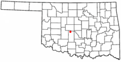
 Location of Minco, Oklahoma |
|
| Coordinates: 35°18′56″N 97°56′45″W / 35.31556°N 97.94583°WCoordinates: 35°18′56″N 97°56′45″W / 35.31556°N 97.94583°W | |
| Country | United States |
| State | Oklahoma |
| County | Grady |
| Area | |
| • Total | 12.3 sq mi (31.9 km2) |
| • Land | 12.3 sq mi (31.8 km2) |
| • Water | 0.04 sq mi (0.1 km2) |
| Elevation | 1,296 ft (395 m) |
| Population (2010) | |
| • Total | 1,632 |
| • Density | 133/sq mi (51.3/km2) |
| Time zone | Central (CST) (UTC-6) |
| • Summer (DST) | CDT (UTC-5) |
| ZIP code | 73059 |
| Area code(s) | 405 |
| FIPS code | 40-48750 |
| GNIS feature ID | 1095428 |
Minco is a city in Grady County, Oklahoma, United States. The population was 1,632 at the 2010 census.
The town was originally included in the Chickasaw Nation, and is believed to be named after the great Chickasaw chief and warrior Itawamba Minco, who later acquired the name of Levi Colbert, who resided on Chickasaw land in Mississippi near Cotton Gin Port. Minco was originally settled sometime around 1890, several years before Oklahoma achieved statehood. In its early stages it was a very busy town because of its location at the end of the Chicago, Rock Island & Pacific Railroad until the railroad was extended further south two years later. Charles B. Campbell owned the occupancy rights of the land that the town was built on. His wife was Miss Maggie (Margaret) Williams, a daughter of W. G. (Caddo Bill) Williams, owner of the Half Moon Ranch, who started Silver City in 1872 by building a trading store for those cattlemen driving their herds of cattle up the Chisholm Trail.
Before the establishment of Minco as a town, three major expeditions passed through the area. The first expedition was conducted by Captain Randolph Marcy in 1849. Marcy was ordered to escort 1,500 individuals headed to the California gold fields. When the expedition approached the Minco area they kept to the south side of Buggy Creek, which Marcy named "Deer Creek". Marcy named his route the Fort Smith to Santa Fe Trail. Interestingly enough there was a road established in 1839-1840 on the north side of the Canadian River that was also named the Fort Smith to Santa Fe Trail. This road had been laid out by Josiah Gregg, a Santa Fe merchant who had connections with merchants in Fort Smith, Arkansas.
During the summer of 1853 the first railroad survey was conducted from Fort Smith to Los Angeles by Lt. Amiel Weeks Whipple. Whipple's survey followed Marcy's route from Fort Smith until they reached the Caddo County Buttes. At that point the expedition moved westward, whereas Marcy had turned north to join the Fort Smith to Santa Fe Trail not far north of Hydro, Oklahoma. Whipple continued westward, leaving Oklahoma just west of the Antelope Hills in Roger Mills County.
...
Wikipedia
