Milseburg
| Milseburg | |
|---|---|

Milseburg, seen from Wasserkuppe
|
|
| Highest point | |
| Elevation | 835 m (2,740 ft) |
| Coordinates | 50°32′42″N 9°53′53″E / 50.54500°N 9.89806°ECoordinates: 50°32′42″N 9°53′53″E / 50.54500°N 9.89806°E |
| Geography | |
| Location | Hesse, Germany |
| Parent range | Rhön Mountains |
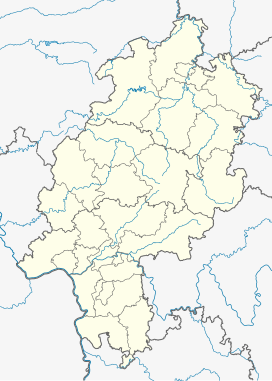
The Milseburg is an extinct volcano and at 835 metres (2,740 ft) above sea level the second highest elevation in the Hessian part of the Rhön Mountains, Germany. The hill is located east of Fulda, near the villages of Kleinsassen and Danzwiesen. It is a popular destination for hikers and bikers. Scientifically, Milseburg is most notable for the remains of a large Celtic oppidum. It also features several other structures on the peak, including a chapel dedicated to St Gangulphus.
The Milseburg is located in the municipality of Hofbieber, east of Fulda in the Rhön hills of Hesse, Germany. It is made up of volcanic basalt. The headwaters of the creek Bieber, a contributor to the Haune are located immediately to the south of the Milseburg. It flows around Milseburg to the west.
Milseburg is the highest elevation in the Western Küppenrhön and the second highest in the Hessian part of the hill range. It rises around 130 metres (427 ft) over the surrounding landscape. It has quite steep slopes on all sides except to the northwest, which offers the only easy access to the top.
A nature reserve of around 26 hectares (created in the 1970s) covers most of the hill.
The Milseburg is most notable, aside from being a landmark, for having been the site of an important Celtic oppidum. It was likely occupied from around 1200 to 800 BC and again from 450 BC to around the turn of the eras. The Ringwall (circular rampart) was one of the largest and most elevated in eastern Hesse. It originally had three gates, only one of which — the Tor am Kälberhutstein — was passable by wagons.
The main fortification was a 1,300 metres (4,265 ft) long stone wall that surrounded the north, east and south sides of the hill at its base. It was discovered as ancient in origin by R. Virchow (1821-1902). However, for a long time it was locally thought to be a modern field border. As a result, when the nearby railway line was built in 1896 most of the wall to the north and northeast was removed and used to make gravel. The wall begins at the scree slope of the Kälberhutstein to the north, slopes in an arch to the southeast and encompasses the whole eastern side of the hill at a distance of 50 metres (164 ft) to 75 metres (246 ft) from its base. The three gates were located to the northeast, east and south. Ch. L. Thomas identified the wall as a pfostenschlitzmauer in 1906.
...
Wikipedia

