Mill en Sint Hubert
| Mill en Sint Hubert | |||
|---|---|---|---|
| Municipality | |||

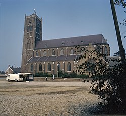
Church in Mill
|
|||
|
|||
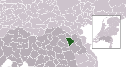
 Location in North Brabant |
|||
| Coordinates: 51°41′N 5°47′E / 51.683°N 5.783°ECoordinates: 51°41′N 5°47′E / 51.683°N 5.783°E | |||
| Country | Netherlands | ||
| Province | North Brabant | ||
| Government | |||
| • Body | Municipal council | ||
| • Mayor | Antoine Walraven (VVD) | ||
| Area | |||
| • Total | 53.17 km2 (20.53 sq mi) | ||
| • Land | 52.28 km2 (20.19 sq mi) | ||
| • Water | 0.89 km2 (0.34 sq mi) | ||
| Elevation | 17 m (56 ft) | ||
| Population (May 2014) | |||
| • Total | 10,847 | ||
| • Density | 207/km2 (540/sq mi) | ||
| Time zone | CET (UTC+1) | ||
| • Summer (DST) | CEST (UTC+2) | ||
| Postcode | 5450–5455 | ||
| Area code | 0485, 0486 | ||
| Website | www |
||
Mill en Sint Hubert (Dutch pronunciation: [mɪl ɛn sɪnt ˈɦybɛrt]) is a municipality in southern Netherlands.
Dutch topographic map of the municipality of Mill en Sint Hubert, June 2015
Aldendriel Castle
Church of Mill
Heilmolen (mill)
Defence canal and bunker
...
Wikipedia


