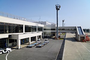
Miho-Yonago Airport
|
Miho Airbase 美保飛行場 Yonago Airport (米子空港) |
|||||||||||
|---|---|---|---|---|---|---|---|---|---|---|---|
 |
|||||||||||
| Summary | |||||||||||
| Airport type | Military/Public | ||||||||||
| Operator | JASDF | ||||||||||
| Serves | Yonago, Tottori, Japan | ||||||||||
| Elevation AMSL | 13 ft / 4 m | ||||||||||
| Coordinates | 35°29′36″N 133°14′21″E / 35.49333°N 133.23917°ECoordinates: 35°29′36″N 133°14′21″E / 35.49333°N 133.23917°E | ||||||||||
| Map | |||||||||||
| Location in Japan | |||||||||||
| Runways | |||||||||||
|
|||||||||||
| Statistics (2014) | |||||||||||
|
|||||||||||
| Passengers | 859,760 |
|---|---|
| Cargo (metric tonnes) | 1,455 |
Miho Airbase (美保飛行場) (IATA: YGJ, ICAO: RJOH), also known as Yonago Airport is a Japan Air Defense Force base located 11km northwest of Yonago in Tottori Prefecture. It is owned and operated by JASDF and shares the runway with civil activities.
The airport was built as an Imperial Japanese Army Air Force airfield during World War II, and was attacked by USAAF B-24 Liberator bombers during July 1945. After the war, the airfield was taken over by the British Commonwealth Occupation Force (BCOF) in Japan. The Royal Australian Air Force No. 5 Airfield Construction Squadron refurbished the airfield, and No. 77 Squadron was stationed at the airfield until 1950.
In December 1950, the United States Air Force 452d Bombardment Wing moved B-26 Invader light bombers to Miho Air Base. They moved to Pusan East (K-9) Air Base, South Korea in May 1951 for combat duty during the Korean War. The only other operational USAF unit to use the airfield was the 17th Bombardment Wing, which also flew B-26s from the field between October 1954 and March 1955 before returning to the United States.
...
Wikipedia

