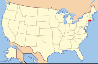
Middlesex County, CT
| Middlesex County, Connecticut | |
|---|---|
| County of Connecticut | |
| County of Middlesex | |

Raymond E Baldwin Courthouse
|
|
 Location in the U.S. state of Connecticut |
|
 Connecticut's location in the U.S. |
|
| Founded | May, 1785 |
| Seat | none (since 1960) Middletown (before 1960) |
| Largest city | Middletown |
| Area | |
| • Total | 439 sq mi (1,137 km2) |
| • Land | 369 sq mi (956 km2) |
| • Water | 70 sq mi (181 km2), 15.9% |
| Population (est.) | |
| • (2016) | 163,329 |
| • Density | 449/sq mi (173/km2) |
| Congressional districts | 1st, 2nd, 3rd |
| Time zone | Eastern: UTC−5/−4 |
Middlesex County is a county in the south central part of the U.S. state of Connecticut. As of the 2010 census, the population was 165,676. The county was created in May 1785 from portions of Hartford County and New London County.
Middlesex County is included in the Hartford-West Hartford-East Hartford metropolitan statistical area known as Greater Hartford.
As with all eight of Connecticut's counties, there is now no county government and no county seat. In Connecticut, towns are responsible for all local government activities, including local police, fire and rescue, snow removal, and schools. In a few cases, neighboring towns will share certain resources, e.g. water, gas, etc. Middlesex County is merely a group of towns on a map, and no longer has any particular authority.
Middletown was the county seat of Middlesex County from its creation in 1785 until the elimination of county government in 1960. There is no government in Middlesex County other than the Middlesex County Judicial District. All county functions other than courts and county sheriff's departments were discontinued in 1960, and again in 2000 when the county sheriff's departments were reorganized as the State of Connecticut Judicial Marshal, due to political corruption in the county sheriff's departments. Joseph E. Bibisi was the last person to serve as high sheriff of Middlesex County.
The county has a total area of 439 square miles (1,140 km2), of which 369 square miles (960 km2) is land and 70 square miles (180 km2) (15.9%) is water. It is the smallest county in Connecticut by land area and second-smallest by total area.
The terrain trends from mostly level along the Connecticut River and Atlantic coast to gently rolling uplands away from them. The highest elevation is close to a triangulation station in Meshomasic State Forest, at 916 feet (279 m) above sea level; the lowest point is sea level.
...
Wikipedia
