Middle Paxton Township, Dauphin County, Pennsylvania
| Middle Paxton Township, Pennsylvania | |
|---|---|
| Township | |

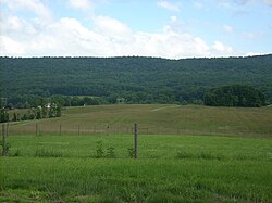
A Middle Paxton Township vista from
Boyd Big Tree Preserve Conservation Area |
|
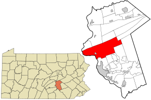
 Location in Dauphin County and state of Pennsylvania |
|
| Country | United States |
| State | Pennsylvania |
| County | Dauphin |
| Settled | 1750 |
| Incorporated | 1787 |
| Area | |
| • Total | 59.2 sq mi (153.2 km2) |
| • Land | 54.4 sq mi (140.9 km2) |
| • Water | 4.7 sq mi (12.3 km2) |
| Population (2010) | |
| • Total | 5,561 |
| • Estimate (2016) | 5,053 |
| • Density | 91/sq mi (35.3/km2) |
| Time zone | Eastern (EST) (UTC-5) |
| • Summer (DST) | EDT (UTC-4) |
| Area code(s) | 717 |
| FIPS code | 42-043-49040 |
| Website | middlepaxtontwp |
Middle Paxton Township is a township in Dauphin County, Pennsylvania, United States. The population was 4,976 at the 2010 census.
In 1729 Paxtang Township of Lancaster County was established. The spelling "Paxtang" is from the original Indian name Peshtank, which meant "standing water". Today the word "Paxton" is used instead of Paxtang.
On March 4, 1785, Lancaster County was split to form Dauphin County, named for the Dauphin of France, heir apparent to the French throne, whose country the area government wanted to honor for its assistance in the Revolutionary War. About two years later in August 1787 the legislature began to splinter Paxtang Township, first into Upper Paxtang, Middle Paxtang and Lower Paxtang.
The John Ayres House was listed on the National Register of Historic Places in 1979.
Middle Paxton Township is in central and western Dauphin County, bordered to the southwest and west by the Susquehanna River. The township is in the Ridge and Valley Province of the Appalachian Mountains; four parallel mountain ridges cross the township from southwest to northeast. The northern border of the township follows the crest of Peters Mountain. Next to the south is Third Mountain, followed by Second Mountain, which forms part of the southern border of the township, and finally Blue Mountain, which forms the remainder of the southern border.
...
Wikipedia
