Middle Palisade
| Middle Palisade | |
|---|---|

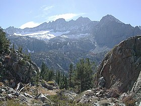
Middle Palisade, from Lone Pine Creek drainage
|
|
| Highest point | |
| Elevation | 14,018 ft (4,273 m) NAVD 88 |
| Prominence | 1,085 ft (331 m) |
| Parent peak | North Palisade |
| Listing |
|
| Coordinates | 37°04′16″N 118°28′10″W / 37.0711425°N 118.4695046°WCoordinates: 37°04′16″N 118°28′10″W / 37.0711425°N 118.4695046°W |
| Geography | |
| Location | Fresno and Inyo counties, California, U.S. |
| Parent range | Sierra Nevada |
| Topo map | USGS Split Mountain |
| Climbing | |
| First ascent | August 26, 1921 by Francis Farquhar and Ansel Hall |
| Easiest route | East Face: Exposed scramble, class 3 |
Middle Palisade is a peak in the Palisades group, part of the central Sierra Nevada mountain range in the U.S. state of California. It is the twelfth highest peak in the state.
Several routes involving exposed scrambling and/or easy technical rock climbing (class 4) exist on the various flanks of Middle Palisade. Some routes involve travel on the Middle Palisade Glacier. The easiest route involves scrambling (class 3) up a chute in the east face of the peak.
...
Wikipedia

