Mid Canterbury
|
Ashburton Hakatere (Māori) |
|
|---|---|
| Secondary urban area | |

Aerial view of Ashburton, looking west. The Ashburton River or Hakatere is visible at left.
|
|
| Nickname(s): Ashvegas | |
| Ashburton | |
| Coordinates: 43°54′20″S 171°44′44″E / 43.90556°S 171.74556°ECoordinates: 43°54′20″S 171°44′44″E / 43.90556°S 171.74556°E | |
| Country |
|
| Region | Canterbury |
| Territorial authority | Ashburton District |
| Electorates | Rangitata Te Tai Tonga (Maori electorate) |
| Government | |
| • Mayor | Donna Favel |
| Area | |
| • Territorial | 6,187.40 km2 (2,388.97 sq mi) |
| Population (June 2016) | |
| • Territorial | 33,700 |
| • Density | 5.4/km2 (14/sq mi) |
| • Urban | 19,850 |
| Demonym(s) | Ashburtonian |
| Time zone | NZST (UTC+12) |
| • Summer (DST) | NZDT (UTC+13) |
| Postcode(s) | 7700 |
| Area code(s) | 03 |
| Website | ashburtondc.govt.nz |
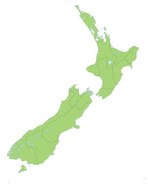
Ashburton or Hakatere (Māori) is a large town in the Canterbury Region, on the east coast of the South Island of New Zealand. The town is the seat of the Ashburton District, a territorial authority encompassing the town and the surrounding rural area, which is also known as Mid Canterbury. It is 85 kilometres (53 mi) south west of Christchurch and is sometimes regarded as a satellite town of Christchurch.
Ashburton township has a population of 19,850, with an additional 12,400 living in the wider district. The town is the 23rd largest urban area in New Zealand and the third-largest urban area in the Canterbury Region, after Christchurch and Timaru.
Ashburton was named by the surveyor Captain Joseph Thomas of the New Zealand Land Association, after Francis Baring, 3rd Baron Ashburton, who was a member of the Canterbury Association. The town is laid out around two central squares either side of the railway line and main highway, Baring Square East and Baring Square West.
"Ashvegas", Ashburton's common nickname, is an ironic allusion to Las Vegas.
Ashburton is on State Highway 1 86 kilometres (53 mi) south of Christchurch. The Main South Line railway line runs through the centre of town, but passenger trains ceased on 10 February 2002. The town is the centre of an agricultural and pastoral farming district, part of the Canterbury Plains. It has one large suburb, Tinwald, south of the town and the Ashburton River. Tinwald was the junction for the now-closed Mount Somers Branch railway line. The town has three other suburbs: Allenton, Hampstead and Netherby.
...
Wikipedia

