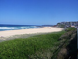
Merewether, New South Wales
|
Merewether Newcastle, New South Wales |
|||||||||||||
|---|---|---|---|---|---|---|---|---|---|---|---|---|---|

Merewether Beach
|
|||||||||||||
| Coordinates | 32°56′34″S 151°45′9″E / 32.94278°S 151.75250°ECoordinates: 32°56′34″S 151°45′9″E / 32.94278°S 151.75250°E | ||||||||||||
| Population | 10,368 (2006 census) | ||||||||||||
| • Density | 3,049.4/km2 (7,898/sq mi) | ||||||||||||
| Established | 1890 | ||||||||||||
| Postcode(s) | 2291 | ||||||||||||
| Area | 6.1 km2 (2.4 sq mi) | ||||||||||||
| Location |
|
||||||||||||
| LGA(s) | City of Newcastle | ||||||||||||
| Region | Hunter | ||||||||||||
| County | Northumberland | ||||||||||||
| Parish | Newcastle | ||||||||||||
| State electorate(s) | Newcastle | ||||||||||||
| Federal Division(s) | Newcastle | ||||||||||||
|
|||||||||||||
Merewether /ˈmɛrɪˌwɛðə/ is a suburb of Newcastle, New South Wales, Australia, located 3 km (2 mi) from Newcastle's central business district with a population of around 10,000. The suburb stretches 3 km (2 mi) from Merewether Beach in the east to Adamstown in the west.
Merewether was originally part of the Burwood Estate, and takes its name from the owner, Edward Christopher Merewether. The Church of England parish church is St.Augustine, in Llewellyn Street, the land and cost of erection met by Mr. Edward Merewether. It became the centre of a new Provisional District in the Diocese of Newcastle in 1890. In 1891 the Census gave the population as 4,700. Merewether was incorporated as a Municipality in 1885, covering 1,110 acres (4.5 km2) and 31 km (19 mi) of streets. The Mayor in 1901 was David Lloyd, a funeral director who resided in Railway Street. The former Council Chambers, opposite the Post Office, are today the clubhouse of the Australian Returned Services League. In 1938 an Act of the New South Wales Parliament created a "City of Greater Newcastle", incorporating 11 municipalities into one local government area, including Merewether.
The dominant industry within the old municipality was coal mining, with the last colliery, at Glebe, not closing until 1959. This was served by a company railway which left the main Government line in the city centre, crossed the main Hunter Street, passed down the centre of Burwood Street, crossed Newcastle's Civic Park, passed under Laman Street and continued along its own permanent way through the suburb of Cook's Hill, to The Junction, past its school then up Merewether Street embankment crossing Llewellyn, Caldwell & Ridge Streets, past the telephone exchange, up Morgan Street, crossing Yule Road to the Newcastle Coal Mining Company's colliery complex. The Happy Valley Colliery (tunnel), opposite Rowan Street, and worked by the Maheen family, also closed about the same time.
...
Wikipedia

