Merced Regional Airport
|
Merced Regional Airport MacReady Field |
|||||||||||
|---|---|---|---|---|---|---|---|---|---|---|---|
 |
|||||||||||

NAIP Aerial Photograph 2009
|
|||||||||||
| Summary | |||||||||||
| Airport type | Public | ||||||||||
| Owner | City of Merced | ||||||||||
| Serves | Merced, California | ||||||||||
| Elevation AMSL | 155 ft / 47 m | ||||||||||
| Coordinates | 37°17′05″N 120°30′50″W / 37.28472°N 120.51389°WCoordinates: 37°17′05″N 120°30′50″W / 37.28472°N 120.51389°W | ||||||||||
| Website | FlyMercedAirport.com | ||||||||||
| Maps | |||||||||||
 Runway diagram |
|||||||||||
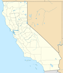
| Location in California | |||||||||||
| Runways | |||||||||||
|
|||||||||||
| Statistics (2015) | |||||||||||
|
|||||||||||
|
Source: Federal Aviation Administration
|
|||||||||||
| Aircraft operations | 58,650 |
|---|---|
| Based aircraft | 61 |
Merced Regional Airport (MacReady Field) (IATA: MCE, ICAO: KMCE, FAA LID: MCE) is two miles southwest of Merced, in Merced County, California. The airport is used for general aviation and sees one airline, subsidized by the Essential Air Service program.
The airport had 2,000 passenger boardings (enplanements) in 2015, a decrease of 0.89% from 2014. The National Plan of Integrated Airport Systems for 2017–2021 categorized it as a general aviation airport (the commercial service category requires 2,500 enplanements per year).
On March 15, 1932 the Merced City Council accepted title to the site of an airport as a gift from the Twenty-Thirty Club and the Crocker-Huffman Company. The airport, an airstrip and 66 acres (0.27 km2) of land 3 miles (4.8 km) northwest of the city near the intersection of U.S. Route 99 and California State Route 59, was dedicated on April 3, 1932. The airport site was leased to George Voight for a term of five years, and a subsidiary airline of the Stinson Aircraft Company started Merced's first scheduled airline service. In May 1936 the City of Merced assumed responsibility for the airport; constructing buildings, hangars, and other improvements; expanding the site to 123 acres (0.50 km2).
In 1940 as the U.S. Army was trying to establish a 30,000 per year basic pilot training facility in the Merced area, Merced Municipal Airport was deemed unsuitable for a major training facility due to lack of room. The United States Department of War would ultimately select an area 2 miles (3.2 km) northeast of Atwater, now the site of Castle Airport, for its Air Corps Basic Flying School. That year, land the Merced Regional Airport now occupies in southwest Merced near Childs Avenue was acquired from delinquent tax rolls. The city council approved the first phase of construction of a new airport shortly after the acquisition. This new city owned airport would be known as "New Merced Municipal Airport".
...
Wikipedia

