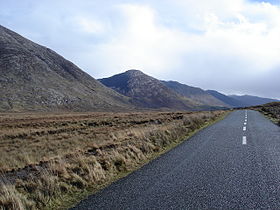
Maumturk Mountains
| Maumturks | |
|---|---|
| Irish: Sléibhte Mhám Toirc | |

Maumturk Mountains, County Galway
|
|
| Highest point | |
| Peak | Barrslievenaroy |
| Elevation | 702 m (2,303 ft) |
| Coordinates | 53°29′N 9°36′W / 53.48°N 9.60°WCoordinates: 53°29′N 9°36′W / 53.48°N 9.60°W |
| Geography | |
| Country | Republic of Ireland |
| Provinces of Ireland | Connacht |
Sléibhte Mhám Toirc (The Maumturks/Maamturks, the Turks (fam.)) are a mountain range in Connemara in the west of Ireland. They are less well known than their more famous neighbours, the Twelve Bens on the other side of the Inagh Valley (and of the Western Way long distance path). They are not very big (max 702m), and dedicated fell runners run from Maumeen in the south to Leenaun in the north in a single day.
The table below lists some of the highest major mountain peaks of the Maumturk Mountains.
The Maumturk Mountains looking across the Inagh Valley from Ben Corr
Peat-cutting near Loch an Imligh
"The Mountains of Connemara : a hill walker's guide" (ISBN ) - includes a 1:50000 map than the OS maps 37, 38, 44.
...
Wikipedia
