Mathews County
| Mathews County, Virginia | ||
|---|---|---|

Mathews County Courthouse Square
|
||
|
||
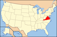
 Location in the U.S. state of Virginia |
||
 Virginia's location in the U.S. |
||
| Founded | 1791 | |
| Seat | Mathews | |
| Area | ||
| • Total | 252 sq mi (653 km2) | |
| • Land | 86 sq mi (223 km2) | |
| • Water | 166 sq mi (430 km2), 65.9% | |
| Population (est.) | ||
| • (2015) | 8,862 | |
| • Density | 106/sq mi (41/km²) | |
| Congressional district | 1st | |
| Time zone | Eastern: UTC-5/-4 | |
| Website | www |
|
Mathews County is a county located in the U.S. state of Virginia. As of the 2010 census, the population was 8,978. Its county seat is Mathews.
Located on the Middle Peninsula, Mathews County is included in the Virginia Beach-Norfolk-Newport News, VA-NC Metropolitan Statistical Area.
At the time of European colonization, the Chiskiake tribe, one of the Algonquian-speaking tribes who were part of the Powhatan Confederacy, inhabited this peninsula at the entrance to Chesapeake Bay. Area lands were transferred to English persons under suspicious circumstances. After the death of his father (and tribal head), a young "boy king", and his "protector", with a name sounding like "Pindavako" to English ears, supposedly signed over the northern areas of the county to the invaders.
During Virginia's colonial era, the area that later became Mathews County was part of Gloucester County. In 1691, the Virginia General Assembly had directed that each county designate an official port-of-entry. Established around 1700, the community of Westville was located along Put-in Creek, a tidal tributary of Virginia's East River feeding into Mobjack Bay, which was a tributary of the Chesapeake Bay.
...
Wikipedia

