Maspalomas Lighthouse

Maspalomas Lighthouse
|
|
|
Canary Islands
|
|
| Location |
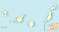
Maspalomas Gran Canaria Canary Islands |
|---|---|
| Coordinates | 27°44′06″N 15°35′56″W / 27.735121°N 15.598934°WCoordinates: 27°44′06″N 15°35′56″W / 27.735121°N 15.598934°W |
| Year first constructed | 1890 |
| Automated | 1973 |
| Construction | stone tower |
| Tower shape | cylindrical |
| Height | 56 metres (184 ft) |
| Focal height | 60 metres (200 ft) |
| Range | 19 nautical miles (35 km; 22 mi) |
| Characteristic | Fl (1+2) W 13s. |
| Admiralty number | D2814 |
| NGA number | 24012 |
| ARLHS number | CAI-018 |
| Spain number | ES-12520 |
| Managing agent | Autoridad Portuaria de Las Palmas de Gran Canaria |
| Heritage |
Bien de Interés Cultural |
|
[]
|
|
The Maspalomas Lighthouse (Spanish: Faro de Maspalomas) is an active 19th century lighthouse at the southern end of the Spanish island of Gran Canaria, in the Canary archipelago. It lies at one end of the Maspalomas beach, 4 kilometres (2.5 mi) south of the resort town centre, next to the area known as the Maspalomas Dunes.
The lighthouse is a distinctive landmark in the resort, and is the tallest masonry lighthouse in the Canaries at 56 m (184 ft), being superseded only by the more modern 59 m (194 ft) concrete Morro Jable lighthouse on Fuerteventura.
With a focal height of 60 m (197 ft) above the sea, its light can be seen for 19 nautical miles, and consists of a pattern of three flashes of white light, over a period of thirteen seconds.
...
Wikipedia

