Mascoutah, Illinois
| Mascoutah | |
| City | |
| Country | United States |
|---|---|
| State | Illinois |
| County | St. Clair |
| Coordinates | 38°29.5′N 89°47.8′W / 38.4917°N 89.7967°WCoordinates: 38°29.5′N 89°47.8′W / 38.4917°N 89.7967°W |
| Area | 9.65 sq mi (25 km2) |
| - land | 9.50 sq mi (25 km2) |
| - water | 0.15 sq mi (0 km2) |
| Population | 7,483 (2010) |
| Density | 655.1/sq mi (253/km2) |
| Timezone | CST (UTC-6) |
| - summer (DST) | CDT (UTC-5) |
| Postal code | 62258 |
| Area code | 618 |
|
Location in St. Clair County and the state of Illinois.
|
|
|
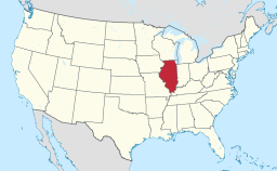
Location of Illinois in the United States
|
|
|
Website: www |
|
Mascoutah is a small city in St. Clair County, Illinois, United States, named for the Mascoutens, a tribe of the Illinois Indians. The population was 7,483 at the 2010 census.
The Mascoutah Civic Center is located at 38°29.5′N 89°47.8′W / 38.4917°N 89.7967°W (38.4922, -89.7968).
According to the 2010 census, Mascoutah has a total area of 9.65 square miles (24.99 km2), of which 9.5 square miles (24.60 km2) (or 98.45%) is land and 0.15 square miles (0.39 km2) (or 1.55%) is water.
Mascoutah was the United States center of population point in 1970. As of the census of 2000, there were 5,659 people, 2,162 households, and 1,571 families residing in the city. The population density was 655.1 people per square mile (252.9/km²). There were 2,309 housing units at an average density of 267.3 per square mile (103.2/km²). The racial makeup of the city was 91.73% White, 4.19% African American, 0.35% Native American, 0.97% Asian, 0.05% Pacific Islander, 0.85% from other races, and 1.86% from two or more races. Hispanic or Latino of any race were 1.75% of the population.
...
Wikipedia


