Maryhill railway station
| Maryhill |
|
|---|---|

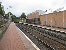
Maryhill station, looking east
|
|
| Location | |
| Place | Maryhill |
| Local authority | Glasgow |
| Coordinates | 55°53′51″N 4°18′06″W / 55.8974°N 4.3016°WCoordinates: 55°53′51″N 4°18′06″W / 55.8974°N 4.3016°W |
| Grid reference | NS561695 |
| Operations | |
| Station code | MYH |
| Managed by | Abellio ScotRail |
| Number of platforms | 2 |
| Live arrivals/departures, station information and onward connections from National Rail Enquiries |
|
| Annual rail passenger usage* | |
| 2011/12 |
|
| 2012/13 |
|
| 2013/14 |
|
| 2014/15 |
|
| 2015/16 |
|
| Passenger Transport Executive | |
| PTE | SPT |
| History | |
| Original company | Glasgow, Dumbarton and Helensburgh Railway |
| Pre-grouping | North British Railway |
| Post-grouping | |
| 28 May 1858 | Opened as Maryhill |
| 2 October 1951 | Closed to passengers |
| 19 December 1960 | Reopened as Maryhill Park |
| 2 October 1961 | Closed to regular trains |
| 2 March 1964 | Closed to passengers |
| 6 December 1993 | Reopened as Maryhill |
| National Rail – UK railway stations | |
| * Annual estimated passenger usage based on sales of tickets in stated financial year(s) which end or originate at Maryhill from Office of Rail and Road statistics. Methodology may vary year on year. | |
|
|
|
Maryhill railway station is a railway station serving the Maryhill area of Glasgow, Scotland. It is located on the Maryhill Line, 8 km (4¾ miles) north west of Glasgow Queen Street, a short distance east of Maryhill Viaduct and Maryhill Park Junction. It has two side platforms. Services are provided by Abellio ScotRail on behalf of Strathclyde Partnership for Transport.
Maryhill was previously the terminus for the eponymous line when it reopened by British Rail in 1993 - the original 1858 Glasgow, Dumbarton and Helensburgh Railway "Maryhill Park" station on the same site (also the junction for the former Kelvin Valley Railway and the Stobcross Railway to Partickhill & Queens Dock) had been closed back in October 1961 by the British Transport Commission and subsequently demolished.
Since 2005 the service has extended to Kelvindale and Anniesland to connect with the North Clyde and Argyle Lines using a reinstated section of the former Stobcross Railway line that had previously been disused since 1980 (when the signal box that formerly controlled the junction was seriously damaged by fire) and then subsequently closed & dismantled. This extension was built to remove the need for terminating services from Queen Street to run empty through to Knightswood North Junction near Westerton in order to reverse before returning to Glasgow - a process that occupied the busy junction there for several minutes whilst the driver changed ends and crossed over from one track to the other. Ending this procedure allowed more trains on the North Clyde Line to pass through the junction, freeing up paths for services from the rebuilt branch line to Larkhall on the south side of the city to run via the Argyle Line through to Milngavie.
...
Wikipedia
