Martin's Additions, Maryland
| Martin's Additions, Maryland | |
|---|---|
| Village | |
 |
|
| Coordinates: 38°58′47″N 77°4′10″W / 38.97972°N 77.06944°WCoordinates: 38°58′47″N 77°4′10″W / 38.97972°N 77.06944°W | |
| Country | |
| State |
|
| County |
|
| Government | |
| • Village Manager | Matt Trollinger |
| Area | |
| • Total | 0.14 sq mi (0.36 km2) |
| • Land | 0.14 sq mi (0.36 km2) |
| • Water | 0 sq mi (0 km2) |
| Elevation | 338 ft (103 m) |
| Population (2010) | |
| • Total | 933 |
| • Estimate (2012) | 963 |
| • Density | 6,664.3/sq mi (2,573.1/km2) |
| Time zone | Eastern (EST) (UTC-5) |
| • Summer (DST) | EDT (UTC-4) |
| FIPS code | 24-50965 |
| GNIS feature ID | 1669431 |
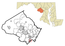
Martin's Additions is a village in Montgomery County, Maryland, United States. It was established as a Special Tax District in 1916 and incorporated as a village in 1985. The population was 933 at the 2010 census.
Martin's Additions is located at 38°58′47″N 77°4′10″W / 38.97972°N 77.06944°W (38.979713, −77.069349).
According to the United States Census Bureau, the village has a total area of 0.14 square miles (0.36 km2), all of it land.
In 1896, Harry M. Martin began buying land from the Chevy Chase Land Company and others and called his holdings "Martin's Additions to Chevy Chase".
In 1916, the area was incorporated as the special tax district of Martin's First, Second, Third and Fourth Additions to the Village of Chevy Chase.
In February 1985, the residents voted in a referendum on whether to incorporate as a town. The vote was 198 to 15 in favor of incorporation. Following approval of Montgomery County and the state of Maryland, the special tax district was incorporated as a municipality called the Village of Martin's Additions on March 19, 1985. The first elected village council members were Michael E. Zielinski, Edward C. Holland, Lucy Foa, Karen McManus, and Paul S. Weller.
As of the census of 2010, there were 933 people, 321 households, and 269 families residing in the village. The population density was 6,664.3 inhabitants per square mile (2,573.1/km2). There were 329 housing units at an average density of 2,350.0 per square mile (907.3/km2). The racial makeup of the village was 92.7% White, 0.6% African American, 3.8% Asian, 0.5% Pacific Islander, 0.9% from other races, and 1.5% from two or more races. Hispanic or Latino of any race were 3.2% of the population.
...
Wikipedia
