Marsens
| Marsens | ||
|---|---|---|
|
||
| Coordinates: 46°39′N 7°4′E / 46.650°N 7.067°ECoordinates: 46°39′N 7°4′E / 46.650°N 7.067°E | ||
| Country | Switzerland | |
| Canton | Fribourg | |
| District | Gruyère | |
| Government | ||
| • Mayor | Syndic | |
| Area | ||
| • Total | 7.81 km2 (3.02 sq mi) | |
| Elevation | 722 m (2,369 ft) | |
| Population (Dec 2015) | ||
| • Total | 1,809 | |
| • Density | 230/km2 (600/sq mi) | |
| Postal code | 1633 | |
| SFOS number | 2140 | |
| Localities | Marsens, Vuippens | |
| Surrounded by | Corbières, Echarlens, Grangettes, Hauteville, Le Châtelard, Pont-en-Ogoz, Riaz, Sâles, Sorens | |
| Website |
www SFSO statistics |
|
Marsens is a municipality in the district of Gruyère in the canton of Fribourg in Switzerland. On 1 January 2001 the former municipality of Vuippens merged into the municipality of Marsens.
Marsens derives its name from the god Mars. Archaeology in the village uncovered a Gallo-Roman temple dedicated to the god, which was destroyed in 260. The site of the temple can be seen today. Marsens is first mentioned in 851 as Curtis marsingus. In 929 it was mentioned as Marsingis and in 1668 it was Marcens. The municipality was formerly known by its German name Marsing, however, that name is no longer used.
Marsens was also well known for the Humilmont convent, the remains of which sit just outside the village.
In more recent times, it is best known as the site of the psychiatric hospital of the canton.
While this region's economy has long been based in agriculture, Marsens today is developing more artisans and industry. The village is expanding as new modern homes are built, but Marsens' pastoral view of the mountains and the sound of nearby cows' bells remains.
Marsens has an area, as of 2009[update], of 7.8 square kilometers (3.0 sq mi). Of this area, 4.96 km2 (1.92 sq mi) or 63.5% is used for agricultural purposes, while 1.94 km2 (0.75 sq mi) or 24.8% is forested. Of the rest of the land, 0.86 km2 (0.33 sq mi) or 11.0% is settled (buildings or roads), 0.02 km2 (4.9 acres) or 0.3% is either rivers or lakes and 0.02 km2 (4.9 acres) or 0.3% is unproductive land.
Of the built up area, housing and buildings made up 6.8% and transportation infrastructure made up 2.3%. Power and water infrastructure as well as other special developed areas made up 1.2% of the area Out of the forested land, 23.3% of the total land area is heavily forested and 1.5% is covered with orchards or small clusters of trees. Of the agricultural land, 8.7% is used for growing crops and 52.4% is pastures and 1.7% is used for alpine pastures. All the water in the municipality is flowing water.
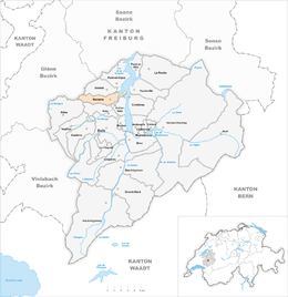
The municipality is located in the Gruyère district. The municipality comprises the small villages of Marsens and its neighbor Vuippens. They are 5 km (16,000 ft) from the town of Bulle, and 20 km (12 mi) from the city of Fribourg.
...
Wikipedia


