Marnate's Bunker
| Dimensions | |
|---|---|
| Length: | 143 meters |
| Width: | 1.80 meters |
| Height: | 2.20 meters |
| Area: | 143 m² |
| Geographical Location | |
| Coordinates: |
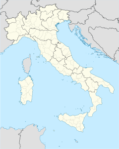
45°38′06″N 8°53′45″E / 45.6351°N 8.8958°ECoordinates: 45°38′06″N 8°53′45″E / 45.6351°N 8.8958°E |
| Country: | Italy |
| Town or City: | Marnate |
| Address: | Via Lazzaretto 128, 21050 Marnate (VA) |
| General Informations | |
| Building type: | Bunker |
| Materials: | Cement and bricks |
| Owner: | Marnate's Town administration |
| Construction Started in: | July 1944 |
| Completed in: | September 1944 |
| Restored in: | May 1991 |
45°38′06″N 8°53′45″E / 45.6351°N 8.8958°ECoordinates: 45°38′06″N 8°53′45″E / 45.6351°N 8.8958°E
Marnate's Bunker is a military monument of World War II, with the purpose of being used as an industrial bunker. It is located in Valle Olona (Varese), Italy, between the boundaries of Marnate, Olgiate Olona and Gorla Minore.
Built by the Germans between July and September 1944, Marnate's Bunker was conquered by the Italian resistance movement on April 26, 1945 after a harsh fight against the German garrison. During the fight, five Germans were killed, while from Garibaldini only a Patriot named Carlo Moltrasio from Fagnano Olona died, and two more were slightly injured. After the surrender of the Germans, the Partisans, while inspecting the bunker, found that it was completely empty, but with a powerful bomb with the purpose of its self-destruction.
...
Wikipedia


