Marlow, New Hampshire
| Marlow, New Hampshire | |
|---|---|
| Town | |

Main Street in 1907
|
|
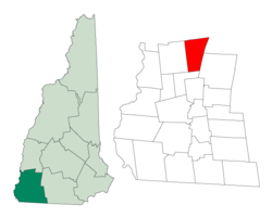
 Location in Cheshire County, New Hampshire |
|
| Coordinates: 43°06′57″N 72°11′49″W / 43.11583°N 72.19694°WCoordinates: 43°06′57″N 72°11′49″W / 43.11583°N 72.19694°W | |
| Country | United States |
| State | New Hampshire |
| County | Cheshire |
| Incorporated | 1761 |
| Government | |
| • Board of Selectmen | Robert Allen, Chair Thomas Fuschetto Edward Thomas |
| Area | |
| • Total | 26.4 sq mi (68.4 km2) |
| • Land | 26.0 sq mi (67.2 km2) |
| • Water | 0.5 sq mi (1.2 km2) 1.78% |
| Elevation | 1,161 ft (354 m) |
| Population (2010) | |
| • Total | 742 |
| • Density | 28/sq mi (11/km2) |
| Time zone | Eastern (UTC-5) |
| • Summer (DST) | Eastern (UTC-4) |
| ZIP code | 03456 |
| Area code(s) | 603 |
| FIPS code | 33-45700 |
| GNIS feature ID | 0873660 |
| Website | www |
Marlow is a town in Cheshire County, New Hampshire, United States. The population was 742 at the 2010 census. Marlow is home to Honey Brook State Forest.
The town was first granted in 1753 by Colonial Governor Benning Wentworth as Addison, after Joseph Addison, secretary of state for England. Addison had signed the appointment papers making the governor's father, John Wentworth, lieutenant-governor of New Hampshire in 1717. As a result of the French War, few original grantees settled here, so it was regranted on October 7, 1761 to William Noyes and 69 others, the majority from Lyme, Connecticut. The town was named after Marlow, England, located on the River Thames in Buckinghamshire.
Marlow bears many marks of glacial action, and minerals are still found here. A woodworking industry once used the water power of the Ashuelot River to produce tools, furniture and wooden buckets from lumber cut nearby. By 1859, when the population was 708, there were seven sawmills, a gristmill, a carriage shop, a tin shop, and two tanneries. Although the town's undulating surface is somewhat rocky, farmers produced hay, grain and vegetables.
...
Wikipedia
