
Marienthal (Ahr)
| Bad Neuenahr-Ahrweiler | ||
|---|---|---|
 |
||
|
||

Bad Neuenahr-Ahrweiler
|
||
|
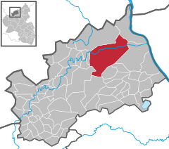
Location of Bad Neuenahr-Ahrweiler within Ahrweiler district
  |
||
| Coordinates: 50°32′41″N 7°6′48″E / 50.54472°N 7.11333°ECoordinates: 50°32′41″N 7°6′48″E / 50.54472°N 7.11333°E | ||
| Country | Germany | |
| State | Rhineland-Palatinate | |
| District | Ahrweiler | |
| Government | ||
| • Mayor | Guido Orthen (CDU) | |
| Area | ||
| • City | 63.38 km2 (24.47 sq mi) | |
| Elevation | 99 m (325 ft) | |
| Population (2015-12-31) | ||
| • City | 27,468 | |
| • Density | 430/km2 (1,100/sq mi) | |
| • Metro | 27,487 | |
| Time zone | CET/CEST (UTC+1/+2) | |
| Postal codes | 53474 | |
| Dialling codes | 02641; 02646 | |
| Vehicle registration | AW | |
| Website | www.bad-neuenahr-ahrweiler.de | |

Bad Neuenahr-Ahrweiler is a renowned spa town in the German Bundesland of Rhineland-Palatinate that serves as the capital of the Ahrweiler district. The A61 motorway connects the town with cities like Cologne and Mainz. Formed by the merging of the towns (now districts) of Bad Neuenahr and Ahrweiler in 1969, Bad Neuenahr-Ahrweiler consists of 11 such districts.
Bad Neuenahr-Ahrweiler rests in the Ahr valley (German: Ahrtal) on the left bank of the Rhine river in the north of Rhineland-Palatinate. Bad Neuenahr-Ahrweiler nestles in the Ahr Hills (German: Ahrgebirge).
The highest hill in the area is the Häuschen at 506 metres (1,660 ft) metres above sea level. Nearby are the hills of Steckenberg, Neuenahrer, and Talerweiterung. There used to be castles on the last two of these hills.
Bad Neuenahr-Ahrweiler is surrounded by the following villages and towns (clockwise from the north): Grafschaft, Remagen, Sinzig, Königsfeld, Rhineland-Palatinate, Schalkenbach, Heckenbach, Kesseling, Rech and Dernau. The nearest cities are Bonn and Koblenz.
...
Wikipedia