Mareeba Shire Council
|
Shire of Mareeba Queensland |
|||||||||||||||
|---|---|---|---|---|---|---|---|---|---|---|---|---|---|---|---|

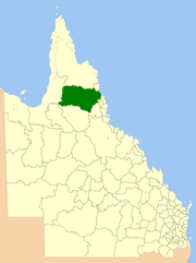
Location within Queensland
|
|||||||||||||||
| Population | 18,212 (2006 census) | ||||||||||||||
| • Density | 0.339708/km2 (0.879839/sq mi) | ||||||||||||||
| Established | 2014 | ||||||||||||||
| Area | 53,610.8 km2 (20,699.2 sq mi) | ||||||||||||||
| Mayor | Tom Gilmore | ||||||||||||||
| Council seat | Mareeba | ||||||||||||||
| Region | Far North Queensland | ||||||||||||||
 |
|||||||||||||||
| Website | Shire of Mareeba | ||||||||||||||
|
|||||||||||||||
The Shire of Mareeba is a local government area at the base of Cape York Peninsula in Far North Queensland, inland from Cairns. The shire, administered from the town of Mareeba, covered an area of 53,610.8 square kilometres (20,699.2 sq mi), and existed as a local government entity from 1879 until 2008, when it amalgamated with several councils in the Atherton Tableland area to become the Tablelands Region.
On 20 March 2013, Mareeba residents voted in favour of a proposal to reverse the amalgamation and to re-establish Mareeba Shire. The new Mareeba Shire was re-established on 1 January 2014.
The Woothakata Division, based in the mining town of Thornborough on the Hodgkinson goldfield, was created on 11 November 1879 as one of 74 divisions around Queensland under the Divisional Boards Act 1879 with a population of 1836. Woothakata is a Wakaman and Kuku Djungan Aboriginal word which describes the way (the journey) they travelled to Ngarrabullgan/Mount Mulligan, an important meeting place. The name Woothakata lives on as the name of a property at Chillagoe.
On 3 September 1881, the Tinaroo Division was created under the Divisional Boards Act 1879 out of parts of the Cairns, Hinchinbrook and Woothakata Divisions.
...
Wikipedia
