Mansfield Township, Warren County, New Jersey
| Mansfield Township, New Jersey | |
|---|---|
| Township | |
| Township of Mansfield | |

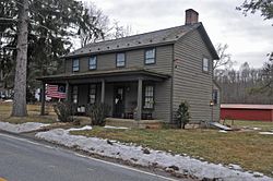
Perry-Petty Farmstead
|
|
 Map of Mansfield Township in Warren County. Inset: Location of Warren County highlighted in the State of New Jersey. |
|
 Census Bureau map of Mansfield Township, Warren County, New Jersey |
|
| Coordinates: 40°48′30″N 74°54′37″W / 40.808466°N 74.91023°WCoordinates: 40°48′30″N 74°54′37″W / 40.808466°N 74.91023°W | |
| Country |
|
| State |
|
| County | Warren |
| Formed | May 30, 1754, as Mansfield-Woodhouse Township |
| Incorporated | February 21, 1798 |
| Named for | William Murray, 1st Earl of Mansfield. |
| Government | |
| • Type | Township |
| • Body | Township Committee |
| • Mayor | Shirley Kocher (R, term ends December 31, 2016) |
| • Clerk | Dena Hrebenak |
| Area | |
| • Total | 29.928 sq mi (77.514 km2) |
| • Land | 29.815 sq mi (77.221 km2) |
| • Water | 0.113 sq mi (0.293 km2) 0.38% |
| Area rank | 91st of 566 in state 3rd of 22 in county |
| Elevation | 820 ft (250 m) |
| Population (2010 Census) | |
| • Total | 7,725 |
| • Estimate (2015) | 7,502 |
| • Rank | 295th of 566 in state 4th of 22 in county |
| • Density | 259.1/sq mi (100.0/km2) |
| • Density rank | 488th of 566 in state 11th of 22 in county |
| Time zone | Eastern (EST) (UTC-5) |
| • Summer (DST) | Eastern (EDT) (UTC-4) |
| ZIP code | 07865 - Port Murray |
| Area code(s) | 908 |
| FIPS code | 3404143320 |
| GNIS feature ID | 0882249 |
| Website | www |
Mansfield Township is a township in Warren County, New Jersey, United States. As of the 2010 United States Census, the township's population was 7,725, reflecting an increase of 1,072 (+16.1%) from the 6,653 counted in the 2000 Census, which had in turn declined by 501 (-7.0%) from the 7,154 counted in the 1990 Census. The township is part of the eastern region of the Lehigh Valley.
What is now Mansfield Township was formed on May 30, 1754, as Mansfield-Woodhouse Township from portions of Greenwich Township, while the area was still part of Sussex County, and was incorporated as Mansfield Township on February 21, 1798, as one of New Jersey's initial group of 104 townships by an act of the New Jersey Legislature. The township became part of the newly formed Warren County on November 20, 1824. Portions of the township were taken to form Franklin Township (April 8, 1839) and Washington Township (April 9, 1849). The township was named after William Murray, 1st Earl of Mansfield.
According to the United States Census Bureau, the township had a total area of 29.928 square miles (77.514 km2), including 29.815 square miles (77.221 km2) of land and 0.113 square mile (0.293 km2) of water (0.38%).
Anderson (with a 2010 Census population of 342), Beattystown (4,554) and Port Murray (129) are unincorporated communities and census-designated places (CDPs) located within the township.
...
Wikipedia
