Manor Township, Lancaster County, Pennsylvania
| Manor Township, Lancaster County, Pennsylvania |
|
|---|---|
| Township | |

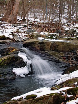
Mann's Creek
|
|
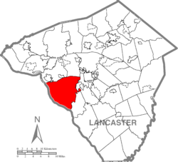
 Map of Lancaster County highlighting Manor Township |
|
| Country | United States |
| State | Pennsylvania |
| County | Lancaster |
| Settled | 1717 |
| Incorporated | 1730 |
| Government | |
| • Type | Board of Supervisors |
| Area | |
| • Total | 48.6 sq mi (126 km2) |
| • Land | 38.5 sq mi (100 km2) |
| • Water | 10.1 sq mi (26 km2) |
| Population (2010) | |
| • Total | 19,612 |
| • Estimate (2016) | 20,756 |
| • Density | 427.9/sq mi (165.2/km2) |
| Time zone | Eastern (EST) (UTC-5) |
| • Summer (DST) | EDT (UTC-4) |
| Area code(s) | 717 |
| FIPS code | 42-071-46992 |
| Website | Manor Township |
Manor Township is a township in west central Lancaster County, Pennsylvania, United States. Manor Township takes its name from the Manor of Conestoga, which was originally surveyed and reserved for William Penn in 1719. It was changed to its present form in 1759. The population was 19,612 at the 2010 census.
Manor Township is one of the six immediate suburbs of the city of Lancaster, all sharing the same official designation as Lancaster, Pennsylvania by the United States Postal Service. With exceptions such as parts of Millersville, 17551. Conestoga 17516, Washington Boro 17582, and Pequea 17565.
Manor Township takes its name from the Manor of Conestoga, which was originally surveyed and reserved for William Penn in 1719. There is evidence that William Penn visited this area prior to 1690. At this time the area was Native American territory. The Susquehannocks were the largest tribe in the Susquenhanna Valley with the center of their community in the Turkey Hill area. The Quaker government had surveyors lay off a large area bounded by the Little Conestoga Creek near Millersville, to the Susquehanna River, and to the Conestoga Creek.
This area was called the Manor of Conestoga, and some historians believe it was set aside as a domain in which the Indians could live and hunt. The Manor contained 16,000 acres east of the Susquehanna River. For the most part the land was flat and well watered, and the soil was rich and fertile.
William Penn had reserved a 3,000 acre site on the eastern bank of the river just north of Turkey Hill for his New Philadelphia. The city would have been at the end of the present Blue Rock Road. Blue Rock Road was an ancient Native American trail prior to the arrival of the white settlers. The road today is known as Route 999 as it leaves Millersville, crosses the Little Conestoga and heads to the river just south of Washington Boro. Blue Rock Ferry, which operated around 1730, was located at the end of Blue Rock Road. Blue Rock Road had great significance and was considered the first gateway to the west.
Following Penn's death three of his sons assumed control of the Manor in the early 1730s. The Swiss-German Mennonites were among the first Europeans to occupy the subdivided lots. H. Frank Eshleman's map of the Manor 1730 (circa), lists 28 property owners and identifies the towns of Washington Boro, Creswell, Safe Harbor, Windom, Letort, Millersville, and Rock Hill. The map shows the 3,000 acres held by the proprietors, approximately 4,000 acres vacant and the area established as Indiantown. Common family names of the people in the Manor were Patterson, Shank, Shenk, Funk, Stoner, Bachman, Hostetter, Herr, Martin, Leaman, Kilhaver, Oberholtzer and Hamilton.
...
Wikipedia
