Manley Hot Springs
|
Manley Hot Springs Too Naaleł Denh |
|
|---|---|
| CDP | |

Manley Hot Springs welcome sign
|
|
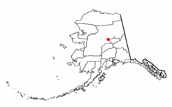
 Location of Manley Hot Springs, Alaska |
|
| Coordinates: 65°0′28″N 150°37′36″W / 65.00778°N 150.62667°WCoordinates: 65°0′28″N 150°37′36″W / 65.00778°N 150.62667°W | |
| Country | United States |
| State | Alaska |
| Census Area | Yukon-Koyukuk |
| Government | |
| • State senator | Click Bishop (R) |
| • State rep. | Dave Talerico (R) |
| Area | |
| • Total | 54.3 sq mi (140.6 km2) |
| • Land | 54.3 sq mi (140.6 km2) |
| • Water | 0.0 sq mi (0.0 km2) |
| Population (2010) | |
| • Total | 89 |
| • Density | 1.6/sq mi (0.63/km2) |
| Time zone | Alaska (AKST) (UTC-9) |
| • Summer (DST) | AKDT (UTC-8) |
| ZIP codes | 99756 |
| Area code | 907 |
| FIPS code | 02-46780 |
Manley Hot Springs (Too Naaleł Denh in Koyukon) is a census-designated place (CDP) in Yukon-Koyukuk Census Area, Alaska, United States. At the 2010 census the population was 89.
Manley Hot Springs is located at 65°0′28″N 150°37′36″W / 65.00778°N 150.62667°W (65.007773, -150.626732).
Manley Hot Springs is located about 8 km (5.0 mi) north of the Tanana River on Hot Springs Slough, at the end of the Elliott Highway, 260 km (160 mi) west of Fairbanks.
According to the United States Census Bureau, the CDP has a total area of 54.3 square miles (141 km2), all of it land.
Manley Hot Springs has a continental subarctic climate (Köppen Dfc).
As of the census of 2000, there were 72 people, 36 households, and 19 families residing in the CDP. The population density was 1.3 people per square mile (0.5/km²). There were 105 housing units at an average density of 1.9/sq mi (0.7/km²). The racial makeup of the CDP was 73.61% White, 23.61% Native American, and 2.78% from other races.
...
Wikipedia
