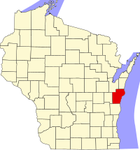
Manitowoc County, Wisconsin
| Manitowoc County, Wisconsin | ||
|---|---|---|
| County | ||
|
||
 Map of Wisconsin showing Manitowoc County |
||
 Wisconsin's location in the United States |
||
| Country |
|
|
| State |
|
|
| Incorporated | 1848 | |
| County seat | City of Manitowoc | |
| Incorporated Municipalities |
30 (total)
|
|
| Government | ||
| • Type | County | |
| • Body | Board of Supervisors | |
| • Board President | Jim Brey | |
| • County Board | 25 commissioners | |
| Area | ||
| • Total | 1,494 sq mi (3,870 km2) | |
| • Land | 589 sq mi (1,530 km2) | |
| • Water | 905 sq mi (2,340 km2) | |
| Area rank | 6th largest county in Wisconsin | |
| Population (2010) | ||
| • Total | 81,442 | |
| • Rank | 21st largest county in Wisconsin | |
| • Density | 138/sq mi (53/km2) | |
| Time zone | Central (UTC-6) | |
| • Summer (DST) | Central (UTC-5) | |
| Area codes | 920 | |
| Congressional districts | 6th | |
| Interstates |
|
|
| U.S. Routes |
|
|
| State Routes |
|
|
| Airports |
|
|
| Waterways |
Lake Michigan – Manitowoc River |
|
| Public transit | Maritime Metro Transit | |
| Website | co.manitowoc.wi.us | |
...
Wikipedia

