Manawatu District
| Manawatu District | |
|---|---|
| Territorial authority | |

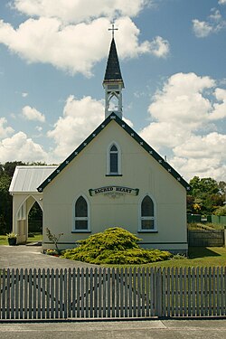
Sacred Heart Catholic Church, Rongotea (c. 1895)
|
|
| Country | New Zealand |
| Region | Manawatu-Wanganui |
| District | Manawatu District Council |
| Wards | Feilding, Kairanga, Kiwitea-Pohangina |
| Seat | Feilding |
| Government | |
| • Mayor | Helen Worboys |
| • Deputy Mayor | Matt Bell |
| Area | |
| • Total | 2,624.115 km2 (1,013.176 sq mi) |
| Population (June 2016) | |
| • Total | 29,800 |
| • Density | 11/km2 (29/sq mi) |
| Time zone | NZST (UTC+12) |
| • Summer (DST) | NZDT (UTC+13) |
| Postcode(s) | Map of postcodes |
| Website | Manawatu District Council |
The Manawatu District is a local government district in the Manawatu-Wanganui Region in the North Island of New Zealand.
Commonly referred to as "The Manawatu", the district is based on the town of Feilding and includes most of the area between the Manawatu River in the south and the Rangitikei River in the north; stretching from slightly south of the settlement of Himatangi in the south, to just south of Mangaweka in the north; and from the Rangitikei River to the summits of the Ruahine Ranges in the east. The district does not include the area around Foxton, Foxton Beach or the mouth of the Manawatu River. It also excludes the area around the city of Palmerston North (including Ashhurst). The district has an area of 2,624 km².
Manawatu is said to have received its name by Hau, the great Māori explorer. On his quest to find his wife who had left him for another lover, Hau is said to have pursued her along the south west coast of the North Island. As he travelled, he came across and named river mouths including Whanganui, Whangaehu and Rangitikei according to events that befell him at the time. He came across a large, wide river mouth. In awe of the sight and in fear he might not be able to cross it, he stated "Ka tū taku manawa" (My heart stands still). [1]
The term Manawatu (often the Manawatu) is also used to refer to a somewhat larger geographical region centred on the floodplain of the Manawatu River, with Palmerston North as its principal city. Like several other geographical regions, such as Wairarapa and the King Country, the Manawatu in this sense never had precisely defined borders, its extents determined largely by custom and preference. Usually included were Palmerston North and all or most of today's Manawatu and Horowhenua Districts. Parts of the Rangitikei and/or Tararua districts could also be included.
...
Wikipedia
