Manatee County, Florida
| Manatee County, Florida | ||
|---|---|---|
| County | ||
| County of Manatee | ||

The Manatee County Courthouse in 2010
|
||
|
||
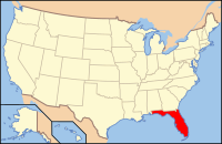
 Location in the U.S. state of Florida |
||
 Florida's location in the U.S. |
||
| Founded | January 9, 1855 | |
| Named for | Florida manatee | |
| Seat | Bradenton | |
| Largest city | Bradenton | |
| Area | ||
| • Total | 893 sq mi (2,313 km2) | |
| • Land | 743 sq mi (1,924 km2) | |
| • Water | 150 sq mi (388 km2), 16.8% | |
| Population (est.) | ||
| • (2015) | 363,369 | |
| • Density | 435/sq mi (168/km²) | |
| Congressional district | 16th | |
| Time zone | Eastern: UTC-5/-4 | |
| Website | www |
|
| Country | USA |
|---|---|
| Type | Public |
| Established | 1964 |
| Location | 1301 Barcarrota Blvd West Bradenton, Florida 14203 |
| Coordinates | 27°29′55.2″N 82°34′29″W / 27.498667°N 82.57472°W |
| Branches | 6 |
| Collection | |
| Items collected | Books, Movies, Newspapers |
| Size | 30,000 |
| Access and use | |
| Population served | 322,000 |
| Members | 20,000 |
| Other information | |
| Budget | $25,000 |
| Staff | 120 |
| Website | www |
Manatee County is a county in the U.S. state of Florida. As of the 2010 census, the population was 322,833. Its county seat and largest city is Bradenton. The county was created in 1855. It was named for the Florida manatee (commonly called a “sea cow” and distantly related to the elephant), which is endangered and Florida’s official marine mammal.
Manatee County is included in the North Port-Sarasota-Bradenton, FL Metropolitan Statistical Area.
Features of Manatee County include access to the Southern part of Tampa Bay, the Sunshine Skyway Bridge, and the Manatee River. Rowing facilities are being developed in the area and the Upper Manatee River Canoe Trail has been created. There are several parks and preserves.
About 1.8 percent of all of Florida’s population lives in Manatee County and it ranks sixteenth amongst Florida counties in population.
The area now known as Manatee County had been inhabited by Native Americans for thousands of years before the southern mouth of the Manatee River was likely the landing site of the De Soto Expedition and is the location of the U.S. National Park Service’s De Soto National Memorial. The area was opened to settlement in 1842 and Manatee County had the Gamble Plantation, a sugar plantation that was one of the South’s finest. The area that Manatee County is in today had a major feature for pioneers – the Manatee River. Most pioneers chose to settle here because of the fertile soil of the Manatee River Valley. The Manatee River was also a deep river which made it a valuable place to settle at. The area Manatee County once had where Hardee County, Highlands County, Sarasota County, DeSoto County, Charlotte County and Glades County.
...
Wikipedia

