Manatee County
| Manatee County, Florida | ||
|---|---|---|
| County | ||
| County of Manatee | ||

The Manatee County Courthouse in 2010
|
||
|
||
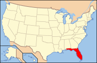
 Location in the U.S. state of Florida |
||
 Florida's location in the U.S. |
||
| Founded | January 9, 1855 | |
| Named for | Florida manatee | |
| Seat | Bradenton | |
| Largest city | Bradenton | |
| Area | ||
| • Total | 893 sq mi (2,313 km2) | |
| • Land | 743 sq mi (1,924 km2) | |
| • Water | 150 sq mi (388 km2), 16.8% | |
| Population (est.) | ||
| • (2016) | 375,888 | |
| • Density | 435/sq mi (168/km²) | |
| Congressional district | 16th | |
| Time zone | Eastern: UTC-5/-4 | |
| Website | www |
|
| Country | USA |
|---|---|
| Type | Public |
| Established | 1964 |
| Location | 1301 Barcarrota Blvd West Bradenton, Florida 14203 |
| Coordinates | 27°29′55.2″N 82°34′29″W / 27.498667°N 82.57472°W |
| Branches | 6 |
| Collection | |
| Items collected | Books, Movies, Newspapers |
| Size | 30,000 |
| Access and use | |
| Population served | 322,000 |
| Members | 20,000 |
| Other information | |
| Budget | $25,000 |
| Staff | 120 |
| Website | www |
Manatee County is a county in the U.S. state of Florida. As of the 2010 census, the population was 322,833. Its county seat and largest city is Bradenton. The county was created in 1855. It was named for the Florida manatee (commonly called a “sea cow” and distantly related to the elephant), which is endangered and Florida’s official marine mammal.
Manatee County is included in the North Port-Sarasota-Bradenton, FL Metropolitan Statistical Area.
Features of Manatee County include access to the Southern part of Tampa Bay, the Sunshine Skyway Bridge, and the Manatee River. Rowing facilities are being developed in the area and the Upper Manatee River Canoe Trail has been created. There are several parks and preserves.
About 1.8 percent of all of Florida’s population lives in Manatee County and it ranks sixteenth amongst Florida counties in population.
The area now known as Manatee County had been inhabited by Native Americans for thousands of years.
The southern mouth of the Manatee River was likely the landing site of the De Soto Expedition and is the location of the U.S. National Park Service’s De Soto National Memorial.
The area was opened to settlement in 1842. The first two settlers were Joseph Braden and Hector Braden who moved into an area near the Manatee River, The two had lost their land for their plantations in Northern Florida during the Panic of 1837. They were said to have heard about that there was abundant land in the area. The brothers moved into a log cabin 5 miles north of the mouth of the Manatee River. Four years later Hector had drowned while trying to cross the Manatee River in his horse during a hurricane. Despite this tragic event Joseph decided that he would still build his sugar plantation, the Braden sugarmill at the mouth of the Manatee River and the Braden River. He later built a dock where Main Street was at and fortified the area near his house building a stockade. A few years later in 1851 he would built the Braden Castle, which was made out of tabby and served as his residence. It would later become a popular tourist attraction in the early 1900s with Tin Can Tourists. He would only stay there for the next six years before moving to Tallahassee.
...
Wikipedia

