Malatya Erhaç Airport
|
Malatya Airport Malatya Havalimanı |
|||||||||||
|---|---|---|---|---|---|---|---|---|---|---|---|
 |
|||||||||||
| Summary | |||||||||||
| Airport type | Public /Military | ||||||||||
| Operator | General Directorate of State Airports Authority | ||||||||||
| Location | Malatya, Turkey | ||||||||||
| Elevation AMSL | 862 m / 2,828 ft | ||||||||||
| Coordinates | 38°26′07″N 038°05′27″E / 38.43528°N 38.09083°ECoordinates: 38°26′07″N 038°05′27″E / 38.43528°N 38.09083°E | ||||||||||
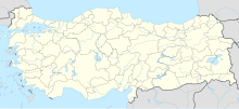
| Map | |||||||||||
| Location of airport in Turkey | |||||||||||
| Runways | |||||||||||
|
|||||||||||
|
Sources: DHMİ and DAFIF
|
|||||||||||
Malatya Airport or Malatya Erhaç Airport (Turkish: Malatya Havalimanı) (IATA: MLX, ICAO: LTAT) is a military and small public airport in Malatya, Turkey. The airport, opened in 1941, is located 34 km (21 mi) from Malatya.
In 2006, Malatya Airport served 3,878 aircraft and 406,425 passengers. The passenger terminal's facilities open to public cover an area of 1,065 m2 (11,460 sq ft) and have a parking lot for 97 cars.
On June 22, 2012, the Turkish Air Force reported that a RF-4E Phantom reconnaissance jet operating from Erhaç went missing over the Mediterranean sea near Syria, with witnesses in the Syrian town of Latakia reporting an aircraft had been shot down by Syrian air defenses. According to DEBKAfile reports, Syrian Armed Forces used Russian-made medium range surface-to-air missile and anti-aircraft artillery weapon system Pantsir-S1 to down the jet.
Erhaç is the 7th Air Wing (Ana Jet Üs or AJÜ) of the 2nd Air Force Command (Hava Kuvvet Komutanligi) of the Turkish Air Force (Türk Hava Kuvvetleri). Other wings of this command are located in Merzifon (LTAP), Diyarbakır (LTCC) and İncirlik (LTAG).
(*)Source: DHMI.gov.tr
...
Wikipedia

