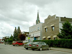
Malartic, Quebec
| Malartic | |
|---|---|
| City | |
 |
|
| Motto: Ma ville, ma famille, ma fierté ("My town, my family, my pride") |
|
 Location within La Vallée-de-l'Or RCM. |
|
| Location in western Quebec. | |
| Coordinates: 48°08′N 78°08′W / 48.133°N 78.133°WCoordinates: 48°08′N 78°08′W / 48.133°N 78.133°W | |
| Country |
|
| Province |
|
| Region | Abitibi-Témiscamingue |
| RCM | La Vallée-de-l'Or |
| Settled | 1928 |
| Constituted | April 28, 1939 |
| Government | |
| • Mayor | André Vezeau |
| • Federal riding | Abitibi—Baie-James— Nunavik—Eeyou |
| • Prov. riding | Abitibi-Est |
| Area | |
| • Total | 157.00 km2 (60.62 sq mi) |
| • Land | 148.68 km2 (57.41 sq mi) |
| Population (2011) | |
| • Total | 3,449 |
| • Density | 23.2/km2 (60/sq mi) |
| • Pop 2006-2011 |
|
| • Dwellings | 1,531 |
| Time zone | EST (UTC−5) |
| • Summer (DST) | EDT (UTC−4) |
| Postal code(s) | J0Y 1Z0 |
| Area code(s) | 819 |
| Highways |
|
| Website | www malartic |
Malartic is a town on the Malartic River in northwestern Quebec, Canada, in the La Vallée-de-l'Or Regional County Municipality. It is located about 80 kilometres (50 mi) east of the centre of Rouyn-Noranda along Quebec Route 117 and the Canadian National Railway.
In addition to the main settlement of Malartic, the municipality also includes the smaller settlement of Norrie.
At the time when the Abitibi region was being surveyed and organized in 1907, the name Malartic was chosen for the geographic township and lake, following the pattern of assigning names of regiments and officers of General Montcalm's army. It was named after Anne Joseph Hippolyte de Maurès, Comte de Malartic, aide de camp to Montcalm.
The discovery of major gold deposits in 1923 led to a gold rush in the Abitibi region, attracting settlers (exclusively men during the first six years) to the area in 1928. In 1935, the Canadian Malartic Gold Mines began operation, employing people from all over the province, Canada, and several east European countries. Together with Eastern Malartic and Malartic Goldfields that began operating in 1937 and 1939 respectively, these three became Quebec's largest gold mines. But newly arriving workers were not permitted to settle near the mines and would build a squatter camp on Crown land about 4 km north of Malartic, that became the community of Roc d'Or. The two settlements grew concurrently, duplicating services. But the parishes (Saint-Martin-de-Tours in 1928), railway station, and post office (1936) were established near the mines in Malartic.
In 1939, the Town of Malartic was incorporated under the auspices of the Quebec Ministry of Mines, in an attempt to halt the proliferation of squatter camps in the Abitibi region. In 1943, the entire community of Roc d'Or was ordered to move to Malartic by the provincial government and the settlement was demolished. Despite a mining accident in April 1947 that killed 12 miners in an underground fire, Malartic was thriving throughout the 1950s, reaching a peak of nearly 7000 residents.
...
Wikipedia

