Mahomet, Illinois
| Mahomet | |
|---|---|
| Village | |

Lake of the Woods, Mahomet, Illinois
|
|
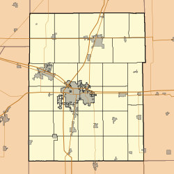
| Location within Champaign County | |
| Coordinates: 40°11′33″N 88°24′8″W / 40.19250°N 88.40222°WCoordinates: 40°11′33″N 88°24′8″W / 40.19250°N 88.40222°W | |
| Country | United States |
| State | Illinois |
| County | Champaign |
| Area | |
| • Total | 9.08 sq mi (23.5 km2) |
| • Land | 9.02 sq mi (23.4 km2) |
| • Water | 0.07 sq mi (0.2 km2) |
| Elevation | 715 ft (218 m) |
| Population (2010) | |
| • Total | 7,258 |
| • Density | 800/sq mi (310/km2) |
| Time zone | CST (UTC-6) |
| • Summer (DST) | CDT (UTC-5) |
| Postal code | 61853 |
| Area code(s) | 217 |
Mahomet /məˈhɒmᵻt/ is a village in Champaign County, Illinois, United States. The population was 7,258 at the 2010 census. Mahomet is located approximately ten miles west of Champaign at the junction of Interstate 74 and IL 47.
Mahomet is located at 40°11′33″N 88°24′8″W / 40.19250°N 88.40222°W (40.192384, -88.402115).
According to the 2010 census, Mahomet has a total area of 9.086 square miles (23.53 km2), of which 9.02 square miles (23.36 km2) (or 99.27%) is land and 0.066 square miles (0.17 km2) (or 0.73%) is water.
As of the census of 2000, there were 4,877 people, 1,654 households, and 1,374 families residing in the village. This figure does not include surrounding subdivisions which would almost double the population. The population density was 711.6 people per square mile (274.9/km²). There were 1,700 housing units at an average density of 248.0 per square mile (95.8/km²). The racial makeup of the village was 98.18% White, 0.14% African American, 0.10% Native American, 0.59% Asian, 0.39% from other races, and 0.59% from two or more races. Hispanic or Latino of any race were 0.94% of the population.
...
Wikipedia


