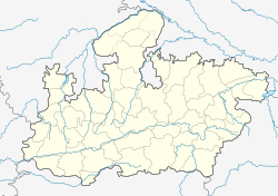
Maharajpur, Madhya Pradesh
| Maharajpur | |
|---|---|
| town | |
| Location in Madhya Pradesh, India | |
| Coordinates: 22°37′N 80°24′E / 22.62°N 80.40°ECoordinates: 22°37′N 80°24′E / 22.62°N 80.40°E | |
| Country |
|
| State | Madhya Pradesh |
| District | Chhatarpur |
| Elevation | 452 m (1,483 ft) |
| Population (2011) | |
| • Total | 4,264 |
| Languages | |
| • Official | Hindi |
| Time zone | IST (UTC+5:30) |
| PIN | 471501 |
| ISO 3166 code | IN-MP |
| Vehicle registration | MP |
Maharajpur is a town and a nagar panchayat in Chhatarpur district in the Indian state of Madhya Pradesh.
Betel leaf cultivation was a source of revenue in the village.
Chhatarpur is located at 22°36′N 80°22′E / 22.6°N 80.37°E. It has an average elevation of 452 metres (1482 feet).
As of 2001[update] India census, Maharajpur had a population of 21,532. Males constitute 53% of the population and females 47%. Maharajpur has an average literacy rate of 53%, lower than the national average of 59.5%: male literacy is 63%, and female literacy is 43%. In Maharajpur, 16% of the population is under 6 years of age.
The current MLA from Maharajpur is Bhanwar Raja (Manvendra Singh) who fought from independent seat and won. Later on become ally of BJP. Previously it was an OBC seat and Ram Prasad Ahirawr was former MLA.
...
Wikipedia

