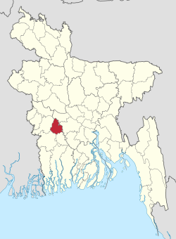
Magura District
|
Magura মাগুরা |
|
|---|---|
| District | |
 Location of Magura in Bangladesh |
|
| Coordinates: 23°24′N 89°24′E / 23.40°N 89.40°ECoordinates: 23°24′N 89°24′E / 23.40°N 89.40°E | |
| Country |
|
| Division | Khulna Division |
| Area | |
| • Total | 1,048.61 km2 (404.87 sq mi) |
| Population (2011 census) | |
| • Total | 918,419 |
| • Density | 880/km2 (2,300/sq mi) |
| Literacy rate | |
| • Total | 28.5% |
| Time zone | BST (UTC+6) |
| Postal code | 7600 |
Magura (Bengali: মাগুরা জেলা) is a district in south-western Bangladesh. It is a part of the Khulna Division. Magura is far from Dhaka by 176 kilometers. The main Transport is bus. From Magura to Dhaka it takes five hours by bus. There is no train transport in Magura.
Magura District (Khulna Division) with an area of 1048 km2, is bounded by Rajbari district to the north, Jessore and Narail districts to the south, Faridpur district to the east and Jhenaidaha district to the west.
Magura district has 4 upazilas. They are:
...
Wikipedia
