Macomb County
| Macomb County, Michigan | ||
|---|---|---|
|
||
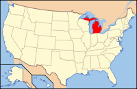
 Location in the U.S. state of Michigan |
||
 Michigan's location in the U.S. |
||
| Founded | January 15, 1818 | |
| Named for | Alexander Macomb | |
| Seat | Mount Clemens | |
| Largest city | Warren | |
| Area | ||
| • Total | 571 sq mi (1,479 km2) | |
| • Land | 479 sq mi (1,241 km2) | |
| • Water | 92 sq mi (238 km2), 16% | |
| Population (est.) | ||
| • (2013) | 854,769 | |
| • Density | 1,755/sq mi (678/km²) | |
| Congressional districts | 9th, 10th | |
| Time zone | Eastern: UTC-5/-4 | |
| Website | macombcountymi |
|
Macomb County is a county located in the eastern portion of the U.S. state of Michigan. As of the 2010 census, the population was 840,978, making it the third-most populous county in the state. Of Michigan's five largest counties, Macomb experienced the most population growth (6.7%) between 2000 and 2010. The county seat is Mt. Clemens.
Macomb County is part of the Detroit-Warren-Dearborn, MI Metropolitan Statistical Area. The city of Detroit is located south of 8 Mile Road, the county's southern border.
Macomb County contains 27 cities, townships and villages, including three of the top ten most populous municipalities in Michigan as of the 2010 census: Warren (#3), Sterling Heights (#4) and Clinton Township (#10). Most of this population is concentrated south of Hall Road (M-59), one of the county's main thoroughfares.
The Ojibwe lived in the area centuries before European contact. The first European explorers arrived in the area during the 17th century. A Moravian colony was established in the county in the late 18th century. They included French fur trappers and missionaries. In addition to the original French and English, later settlers included Germans, Belgians and others who came directly from Europe. In the 19th century the county received many American migrants from New York and New England who were attracted to the area for land and booming jobs.
...
Wikipedia

