Mackinac County
| Mackinac County, Michigan | |
|---|---|
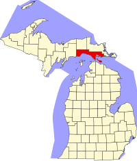
 Location in the U.S. state of Michigan |
|
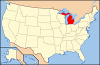
 Michigan's location in the U.S. |
|
| Founded | October 26, 1818 organized 1849 |
| Named for | Straits of Mackinac |
| Seat | St. Ignace |
| Largest city | St. Ignace |
| Area | |
| • Total | 2,101 sq mi (5,442 km2) |
| • Land | 1,022 sq mi (2,647 km2) |
| • Water | 1,079 sq mi (2,795 km2), 51% |
| Population | |
| • (2010) | 11,113 |
| • Density | 11/sq mi (4/km²) |
| Congressional district | 1st |
| Time zone | Eastern: UTC-5/-4 |
| Website | www |
Mackinac County is a county in the Upper Peninsula of the U.S. state of Michigan. As of the 2010 census, the population was 11,113. The county seat is St. Ignace. Formerly known as Michilimackinac County, in 1818 it was one of the first counties of the Michigan Territory, as it had long been a center of French and British colonial fur trading, a Catholic church and Protestant mission, and associated settlement.
The county's name is believed to be shortened from "Michilimackinac", which referred to the Straits of Mackinac area as well as the French settlement at the tip of the lower peninsula.
Michilimackinac County was created on October 26, 1818, by proclamation of territorial governor Lewis Cass. The county originally encompassed the Lower Peninsula of Michigan north of Macomb County and almost the entire present Upper Peninsula. As later counties were settled and organized, they were divided from this territory.
At the time of founding, the county seat was the community of Michilimackinac Island on Michilimackinac Island, later known as Mackinac Island, Michigan. This has been an important center for fur trading before the 1830s, when European demand declined. The county was organized in 1849 as Mackinac County. In 1882 the county seat was moved from Mackinac Island to St. Ignace, Michigan, which had been founded as a French Jesuit mission village during the colonial years.
...
Wikipedia
