Mabalacat
| Mabalacat | ||
|---|---|---|
| Component City | ||

Mabalacat City Hall
|
||
|
||
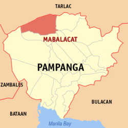
 Map of Pampanga showing the location of Mabalacat |
||
| Location within the Philippines | ||
| Coordinates: 15°13′N 120°35′E / 15.217°N 120.583°ECoordinates: 15°13′N 120°35′E / 15.217°N 120.583°E | ||
| Country | Philippines | |
| Region | Central Luzon (Region III) | |
| Province | Pampanga | |
| District | 1st District | |
| Founded | 1712 | |
| Cityhood | July 21, 2012 | |
| Barangays | 27 | |
| Government | ||
| • Mayor | Marino P. Morales (Lakas Kampi CMD) | |
| • Vice Mayor | Christian Halili (IND) | |
| • Representative 1st District | Carmelo "Jon" Lazatin II Lingap Lugud |
|
| Area | ||
| • Total | 83.18 km2 (32.12 sq mi) | |
| Population (2015) | ||
| • Total | 250,799 | |
| • Density | 3,000/km2 (7,800/sq mi) | |
| Time zone | PST (UTC+8) | |
| ZIP code | 2010 | |
| IDD : area code | +63 (0)45 | |
| Income class | 1st class | |
| Website | mabalacatcity |
|
Mabalacat, officially the City of Mabalacat (Kapampangan: Lakanbalen ning Mabalacat; Filipino: Lungsod ng Mabalacat) or simply referred to as Mabalacat City, is a component city in the northern part of the province of Pampanga in Central Luzon, Philippines. The former municipality was officially converted into a city following a referendum on July 21, 2012 and became the third in Pampanga after Angeles City and San Fernando. According to the 2010 census, it has a population of 215,610 people.
The city's name is derived from indigenous Negrito word mabalacat meaning "forest of balacats".
Mabalacat has a land area of 83.18 square kilometres (32.12 sq mi). Roughly 60% of the Clark Freeport Zone is located in Mabalacat, the rest in nearby Angeles City, where the Clark main gate is located and which is served by the Clark International Airport with its numerous hotels, casinos, golf courses, and resorts.
The soil is charcoal black and shiny, a sign of fertility, and is suitable for growing rice, sugarcane and other rootcrops. Like the neighbouring cities of Angeles and San Fernando and the towns/municipalities of Porac, Bacolor, Santa Rita, Mexico, Magalang and Arayat, this city never gets inundated by floods from heavy rains and typhoons because it is situated on an elevated, well-drained plain known as the "Upper Pampanga".
Mabalacat is politically subdivided into 27 barangays.
The largest barangay is Dau, which became a barrio in 1936 by virtue of Presidential Proclamation Number 1. It is now a business center whose commercial output runs parallel to that of downtown. A former terminus of the North Luzon Expressway, it is the most urban and most populous area in Mabalacat, home to roughly 23% of the city's population.
...
Wikipedia


