Lyshornet
| Lyshornet | |
|---|---|
|
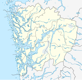
Location in Hordaland
|
|
| Highest point | |
| Elevation | 404 m (1,325 ft) |
| Prominence | 327 m (1,073 ft) |
| Coordinates | 60°14′26″N 05°24′23″E / 60.24056°N 5.40639°ECoordinates: 60°14′26″N 05°24′23″E / 60.24056°N 5.40639°E |
| Geography | |
| Location | Hordaland, Norway |
| Climbing | |
| Easiest route | Hiking |
Lyshornet is a mountain in the municipality of Os, Hordaland, Norway. The 404-metre (1,325 ft) tall mountain lies about 3 kilometres (1.9 mi) north of the village of Søvik and about 2 kilometres (1.2 mi) west of the village of Søfteland. The Lyse Abbey lies at the southern base of the mountain.
...
Wikipedia

