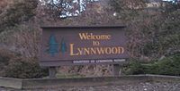
Lynnwood, Washington
| City of Lynnwood | |
|---|---|
| City | |
 |
|
 Location of Lynnwood, Washington |
|
| Coordinates: 47°49′40″N 122°18′19″W / 47.82778°N 122.30528°WCoordinates: 47°49′40″N 122°18′19″W / 47.82778°N 122.30528°W | |
| Country | United States |
| State | Washington |
| County | Snohomish |
| Government | |
| • Mayor | Nicola Smith |
| Area | |
| • Total | 7.86 sq mi (20.36 km2) |
| • Land | 7.84 sq mi (20.31 km2) |
| • Water | 0.02 sq mi (0.05 km2) |
| Elevation | 350-600 ft (167-182 m) |
| Population (2010) | |
| • Total | 36,485 |
| • Estimate (2015) | 36,997 |
| • Density | 4,570.9/sq mi (1,764.8/km2) |
| Time zone | PST (UTC-8) |
| • Summer (DST) | PDT (UTC-7) |
| ZIP codes | 98026, 98036, 98037, 98046, 98087 |
| Area code | 425 |
| FIPS code | 53-40840 |
| GNIS feature ID | 1512414 |
| Website | www.ci.lynnwood.wa.us |
Lynnwood is a city in Snohomish County, Washington, United States. The population was 36,485 at the 2010 census, making it the fourth largest in Snohomish County and thirtieth largest in Washington State. The city is a mix of urban, suburban, small city, crossroads, and bedroom community to many professionals who work in Seattle. Lynnwood is known to be the "hub city" of south Snohomish County because of all the retail shopping. Straddling the junction between Interstate 5 and the north end of Interstate 405 in Washington, it is a part of "Greater Seattle". The center of the town at 44th Avenue West and 196th Southwest has the usual American panoply of small businesses, strip malls, and retail stores. Outside the commercial center of Lynnwood, to the east and north, lie Alderwood Mall, houses, and portions of the green belt.
In 1889, William Morrice purchased 100 acres of land which is now the site of the Alderwood mall. Only a few pioneering families lived in this remote central part of South Snohomish County. A trip to Seattle for supplies took two days by horse-drawn wagon.
Early in the twentieth century, the area occupied by Lynnwood today was owned by the Puget Mill Company. Logging began and by 1916, most of the timber had been cut and the Puget Mill Company was liable for taxes on 6,285 acres of unproductive land. Puget Mill began selling five-acre "stump farms" and in 1917 they developed a 30-acre poultry farm, known as the Demonstration Farm, to demonstrate how a farmer might make a five-acre tract pay for itself. The Demonstration Farm was located next to the Interurban Railway that ran between Seattle and Everett. Across the tracks from the Demonstration Farm, ten acres were set aside as urban lots, and a brick Tudor-style general store was built to serve the growing new community of Alderwood Manor.
State Route 99 opened in October 1927 and brought major changes to the area. In 1931, a road (now 196th St SW) was paved connecting Alderwood Manor to State Route 99, and for a decade the highway corridor and the rail corridor complemented one another.
...
Wikipedia
