Lutherville
| Lutherville, Maryland | |
|---|---|
| Census-designated place | |
| Nickname(s): Old Original | |
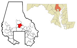
 Location of Lutherville, Maryland |
|
| Coordinates: 39°25′26″N 76°37′3″W / 39.42389°N 76.61750°WCoordinates: 39°25′26″N 76°37′3″W / 39.42389°N 76.61750°W | |
| Country | |
| State |
|
| County |
|
| Area | |
| • Total | 2.1 sq mi (5.5 km2) |
| • Land | 2.1 sq mi (5.5 km2) |
| • Water | 0.0 sq mi (0.0 km2) |
| Population (2010) | |
| • Total | 6,504 |
| • Density | 3,100/sq mi (1,200/km2) |
| Time zone | Eastern (EST) (UTC-5) |
| • Summer (DST) | EDT (UTC-4) |
| ZIP codes | 21093-21094 |
| Area code(s) | 410, 443 |
Lutherville is a census-designated place (CDP) in Baltimore County, Maryland, United States. As of the 2010 census it had a population of 6,504. Prior to 2010 the area was part of the Lutherville-Timonium CDP. Within its borders lies the Lutherville Historic District.
Lutherville is located at 39°25′26″N 76°37′3″W / 39.42389°N 76.61750°W (39.4240, -76.6177).
According to the United States Census Bureau, the CDP had a total area of 2.1 square miles (5.5 km2), all of it land.
The town is located north of Baltimore City along York Road (Maryland Route 45). It is bordered on the north by Timonium, on the west by Interstate 83, on the south by Towson, and on the east by the Hampton neighborhood. The boundary between Lutherville and Timonium is Ridgely Road.
Lutherville is located in the Piedmont region of the United States, and lies in the Humid subtropical climate zone, with hot and humid summers leading into winters that are chilly but not extreme by American standards. The average annual snowfall is 25 inches (64 cm) and average annual rainfall is 42 inches (107 cm).
...
Wikipedia
