Luddesdown
| Luddesdown | |
|---|---|
 The Cock Inn, Henley Street, Luddesd'n |
|
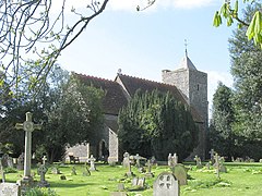
 The Church of St Peter and St Paul |
|
| Luddesdown shown within Kent | |
| Population | 220 (2011) |
| OS grid reference | TQ675665 |
| District | |
| Shire county | |
| Region | |
| Country | England |
| Sovereign state | United Kingdom |
| Post town | Gravesend |
| Postcode district | DA12 |
| Police | Kent |
| Fire | Kent |
| Ambulance | South East Coast |
| EU Parliament | South East England |
| UK Parliament | |
Luddesdown (/ˈlʌdsˌdən/) is a civil parish in the Gravesham District of Kent, England.
This very rural parish, forming part of the North Downs Area of Outstanding Natural Beauty, is located in a dry valley to the south of Gravesend and is named after a scattered group of houses and farms around Luddesdown Court and its church next to it.
The civil parish also contains its main neighbourhood or street, Henley Street, and separate hamlets of Great Buckland (though split down the side with Snodland having essentially the Church) and Boughurst Street to the south; the valley narrows quickly the south to the appropriately named Buckland at the top of the dry valley floor. In this steep valley, facing west, is a vineyard, Monk's Vineyard; east are these woods: College, Haydown, Brazenden, Scrubes, Wrenches, Goss Hilly and Red Wood to the north east. Apart from this eastern edge, there are Fowles/Brimp, Luxon, Molehill, Freezelands, Round, Tom Loft's, Longfield and Henley Woods. These are part of the now long and narrow Rochester Forest, much of which would have been used for the chandlery/shipbuilding of the Medway towns. Most afford access under the 2000 Act. There are two country public houses within the area.
Luddesdown is first recorded in 975 as Hludes duna (Hlud's hill); in 1186 it was Ludesdon and in 1610 Luddesdowne. It is pronounced Ludsdun. In 939 there was a mound nearby called Hludes beorh - suggesting that Hlud was a prominent citizen.
...
Wikipedia

