Luckey, Ohio
| Luckey, Ohio | |
|---|---|
| Village | |

Main Street downtown
|
|
 Location of Luckey, Ohio |
|
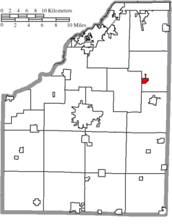
 Location of Luckey in Wood County |
|
| Coordinates: 41°27′3″N 83°29′6″W / 41.45083°N 83.48500°WCoordinates: 41°27′3″N 83°29′6″W / 41.45083°N 83.48500°W | |
| Country | United States |
| State | Ohio |
| County | Wood |
| Township | Troy |
| Government | |
| • Mayor | Belinda M. Brooks |
| Area | |
| • Total | 0.69 sq mi (1.79 km2) |
| • Land | 0.69 sq mi (1.79 km2) |
| • Water | 0 sq mi (0 km2) |
| Elevation | 666 ft (203 m) |
| Population (2010) | |
| • Total | 1,012 |
| • Estimate (2012) | 1,026 |
| • Density | 1,466.7/sq mi (566.3/km2) |
| Time zone | Eastern (EST) (UTC-5) |
| • Summer (DST) | EDT (UTC-4) |
| ZIP code | 43443 |
| Area code(s) | 419 |
| FIPS code | 39-45332 |
| GNIS feature ID | 1048939 |
| Website | http://luckeyohio.org/ |
Luckey is a village in Wood County, Ohio, United States. The population was 1,012 at the 2010 census.
Luckey was named for Captain James B. Luckey, who served in the US Army from 1861 to 1864. In 1879 he bought 180 acres of land and built a saw mill on the site of the village. In 1881 Isaac Krotzer surveyed the town, and several businesses were established including a post office, stave factory, and hotel. A post office called Luckey has been in operation since 1881. The village was incorporated in 1940.
Luckey is located at 41°27′3″N 83°29′6″W / 41.45083°N 83.48500°W (41.450889, -83.484872).
According to the United States Census Bureau, the village has a total area of 0.69 square miles (1.79 km2), all land.
As of the census of 2010, there were 1,012 people, 383 households, and 283 families residing in the village. The population density was 1,466.7 inhabitants per square mile (566.3/km2). There were 405 housing units at an average density of 587.0 per square mile (226.6/km2). The racial makeup of the village was 97.6% White, 0.2% African American, 0.8% Asian, 0.1% from other races, and 1.3% from two or more races. Hispanic or Latino of any race were 3.4% of the population.
...
Wikipedia
