Lowes, Kentucky
| Lowes, Kentucky | |
|---|---|
| Census-designated place | |
 |
|
| Coordinates: 36°53′08″N 88°46′26″W / 36.88556°N 88.77389°WCoordinates: 36°53′08″N 88°46′26″W / 36.88556°N 88.77389°W | |
| Country | United States |
| State | Kentucky |
| County | Graves |
| Area | |
| • Total | 0.7 sq mi (1.8 km2) |
| • Land | 0.7 sq mi (1.8 km2) |
| • Water | 0.0 sq mi (0.0 km2) |
| Elevation | 469 ft (143 m) |
| Population (2010) | |
| • Total | 98 |
| • Density | 143/sq mi (55.2/km2) |
| Time zone | Central (CST) (UTC-6) |
| • Summer (DST) | CDT (UTC-5) |
| Area code(s) | 270 & 364 |
| GNIS feature ID | 497318 |
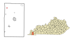
Lowes is an unincorporated community and census-designated place (CDP) in Graves County, Kentucky, United States. Lowes is 13 miles (21 km) northwest of Mayfield. As of the 2010 census the population of Lowes was 98.
...
Wikipedia
