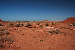
Low Monte
| Argentine Monte (NT0802) | |
|---|---|

Desert near Barreales lake, Neuquén Province
|
|
| Ecology | |
| Realm | Neotropical |
| Biome | Temperate grasslands, savannas, and shrublands |
| Geography | |
| Area | 408,959 km2 |
| Countries | Argentina |
| Coordinates | 38°41′24″S 67°35′49″W / 38.690°S 67.597°WCoordinates: 38°41′24″S 67°35′49″W / 38.690°S 67.597°W |
| Climate type | BSk: arid, steppe, cold arid |
The Argentine Monte (NT0802), or Low Monte, is an ecoregion of dry thorn scrub and grasslands in Argentina. It is much the driest region in the country. Human settlements are mainly near water supplies such as rivers or oases. Deforestation and over-grazing around these settlements have caused desertification.
The Argentine Monte is in north-central Argentina, and has an area of 40,895,912 hectares (101,056,000 acres). It is to the east of the Andes and extends from Salta Province in the north to Chubut Province in the south. It covers the eastern foothills of the Andes. The ecoregion merges into the Patagonian steppe in the south, where it extends east to the Atlantic Ocean. In the north it lies between areas of Dry Chaco and Southern Andean Yungas to the east, and Central Andean puna and Southern Andean steppe to the west. In south it lies between Espinal to the east and Patagonian steppe to the west.
Elevations range from sea level on the Atlantic coast to 2,800 metres (9,200 ft). The region contains parts of the watersheds of the Rio Negro and Rio Colorado. The Lagunas de Guanacache, Desaguadero y del Bebedero in Mendoza Province form the most important wetland in the ecoregion, designated a Ramsar site. This is a long chain of lagoons and marshes covering 10,000 square kilometres (3,900 sq mi) fed by the Mendoza and San Juan rivers, which drains into the Desaguadero River. The lakes and streams are mostly seasonal or intermittent.
...
Wikipedia
