Lovelady, Texas
| Lovelady, Texas | |
|---|---|
| City | |

Lovelady City Hall
|
|
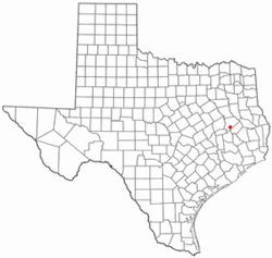
 Location of Lovelady, Texas |
|
 |
|
| Coordinates: 31°7′42″N 95°26′42″W / 31.12833°N 95.44500°WCoordinates: 31°7′42″N 95°26′42″W / 31.12833°N 95.44500°W | |
| Country | United States |
| State | Texas |
| County | Houston |
| Area | |
| • Total | 1.1 sq mi (2.9 km2) |
| • Land | 1.1 sq mi (2.9 km2) |
| • Water | 0.0 sq mi (0.0 km2) |
| Elevation | 299 ft (91 m) |
| Population (2000) | |
| • Total | 608 |
| • Density | 543.9/sq mi (210.0/km2) |
| Time zone | Central (CST) (UTC-6) |
| • Summer (DST) | CDT (UTC-5) |
| ZIP code | 75851 |
| Area code(s) | 936 |
| FIPS code | 48-44260 |
| GNIS feature ID | 1361884 |
Lovelady is a city in Houston County, Texas, United States. The population was 608 at the 2000 census.
Lovelady was founded by investors of the Houston & Great Northern Railroad as a railway line was built through a land grant of Cyrus Lovelady, near the communities of Nevil's Prairie, Pennington, and Weldon. The U.S. Post Office opened on Nov. 8, 1872. The town soon had livery, stables, blacksmith shop, and hotels, prospering as both a marketplace and a shipping point. By 1876 a public school was held in a local log house. Lovelady was incorporated in 1927.
The Porter Place Ranch at Lovelady, founded in 1912 by V. H. "Hoyt" Porter, is the setting of many prized photographs by Porter's son-in-law, Guy Gillette, who spent many summers at the ranch with his wife, Doris Porter Gillette, and their two sons. In 2013, Andy Wilkinson of Lubbock, Texas, published through the University of Oklahoma Press a coffee-table book, A Family of the Land: The Texas Photography of Guy Gillette, a photo-account of Gillette's career. Based on pictures that Gillette took dating back to the 1940s, the volume documents ranching, family, and small-town life, including downtown activities on Saturdays: the café, drug store, barbershop, city streets, and marching band and Sunday church activities: homecoming, dinner on the ground, and Bible school.
Lovelady is located at 31°7′42″N 95°26′42″W / 31.12833°N 95.44500°W (31.128422, -95.445035).
According to the United States Census Bureau, the city has a total area of 1.1 square miles (2.8 km2), of which, 1.1 square miles (2.8 km2) of it is land and 0.88% is water.
...
Wikipedia
