Louisa, Kentucky
| City of Louisa, Kentucky | |
|---|---|
| City | |

Main Street
|
|
| Nickname(s): "Gem of the Big Sandy" | |
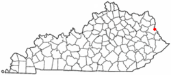
 Location of Louisa, Kentucky |
|
| Coordinates: 38°6′43″N 82°36′21″W / 38.11194°N 82.60583°WCoordinates: 38°6′43″N 82°36′21″W / 38.11194°N 82.60583°W | |
| Country | United States |
| State | Kentucky |
| County | Lawrence |
| Established | December 11, 1822 |
| Incorporated | 1869 |
| Government | |
| • Type | Mayor-Council |
| • Mayor | Harold Slone |
| Area | |
| • Total | 1.4 sq mi (3.6 km2) |
| • Land | 1.3 sq mi (3.5 km2) |
| • Water | 0.0 sq mi (0.1 km2) |
| Elevation | 584 ft (178 m) |
| Population (2010) | |
| • Total | 2,467 |
| • Density | 1,762.1/sq mi (685.3/km2) |
| Time zone | Eastern (EST) (UTC-5) |
| • Summer (DST) | EDT (UTC-4) |
| ZIP codes | 41201, 41230 |
| Area code(s) | 606 |
| FIPS code | 21-47854 |
| GNIS feature ID | 0497204 |
| Website | City of Louisa |
Louisa is a home rule-class city located at the merger of the Levisa and Tug Forks into the Big Sandy River. It is located in Lawrence County, Kentucky, in the United States and is the seat of its county. The population was 2,467 at the 2010 census.
The origin of the city's name is unclear. Theories include that it was named for Louisa County, Virginia, or a corruption of the name of the Levisa or that it was named after Louisa Swetnam, one of the first white children born in the area. The Levisa Fork was originally written and spoken as the "Louisa Fork" which is the likely origin of the name. It is also possible that the town name was connected to the Spanish Era in Kentucky. Spain made land grants in what is now Kentucky. Explorer Dr. Thomas Walker named the river after a family member. Others claim that the Levisa Fork is named for Levite connections to the Cherokee and other Indian Tribes prior to later European contact. An 1856 map still shows the river under the name "Louisa." Virginia and Carolina and other English colonial linked settlement attempts began as early as 1790 but did not take hold until 1818. Louisa became the county seat in 1822 and a city in 1823.
During the Civil War, Union troops under future president James A. Garfield occupied the city from December 1861 until the end of the war, despite several Confederate takeover attempts. The Confederate Army of East Kentucky merged with Virginia and Tennessee Confederate units. Kentucky had a star on the Confederate Battle Flag, and Jefferson Davis was born in Kentucky, and graduated from a Kentucky college.
The Chattaroi Railroad (now a part of CSX) connected to Louisa in 1881. The city is also served by US 23. The first needle dam constructed in the United States was completed just north of town in 1896.
...
Wikipedia
