Loggerhead Key

National Park Service map of the Dry Tortugas
|
|
| Geography | |
|---|---|
| Location | end of the Florida Keys, United States |
| Coordinates | 24°38′00″N 82°55′12″W / 24.63333°N 82.92000°WCoordinates: 24°38′00″N 82°55′12″W / 24.63333°N 82.92000°W |
| Archipelago | Florida Keys |
| Adjacent bodies of water | Gulf of Mexico |
| Total islands | 7 |
| Major islands | Garden Key |
| Area | 143 acres (58 ha) |
| Highest elevation | 0 ft (0 m) |
| Administration | |
|
United States
|
|
| State | Florida |
| County | Monroe County |
| Census County Division | Lower Keys |
| Demographics | |
| Demonym | American |
| Population |
|
| Additional information | |
| Time zone | |
| • Summer (DST) | |
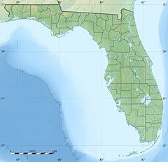
The Dry Tortugas are a small group of islands, located in the Gulf of Mexico at the end of the Florida Keys, United States, about 67 miles (108 km) west of Key West, and 37 miles (60 km) west of the Marquesas Keys, the closest islands. Still further west is the Tortugas Bank, which is submerged. The first Europeans to discover the islands were the Spanish in 1513, led by explorer Juan Ponce de León. They are an unincorporated area of Monroe County, Florida, and belong to the Lower Keys Census County Division. With their surrounding waters, they constitute the Dry Tortugas National Park.
The keys are low and irregular. Some keys have thin growths of mangroves, and various other vegetation, while others have only small patches of grass, or are devoid of plant life. In general, they rise abruptly from relatively deep water. They are continually changing in size and shape. The Tortugas Atoll has had up to 11 islets during the past two centuries. Some of the smaller islands have disappeared and reappeared multiple times as a result of hurricane impact.
The total area of the islets, some of which are little more than sand bars just above the water mark, is about 580,000 square meters (143 acres). Their area changes over time as wind and waves reshape them. There are seven islets, which are from West to East:
The three westernmost keys, which are also the three largest keys (Loggerhead Key, Garden Key, and Bush Key), make up about 93 percent of the total land area of the group.
Formerly existing keys were, from West to East:
The islands get their name from their distinctive characteristics: Turtles, because Ponce de León, a Spanish explorer, saw several big sea turtles on the island. Soon afterward, the word "Dry" was added to the name, to indicate to mariners the islands' lack of springs.[4] Later seafarers would keep the turtles on their backs in the holds of sailing ships and butcher them when they wanted fresh meat. They are not related to the Caribbean island of Tortuga, near Hispaniola.
...
Wikipedia

