Logan, OH
| Logan, Ohio | |
|---|---|
| City | |

West Main Street in downtown Logan in 2006
|
|
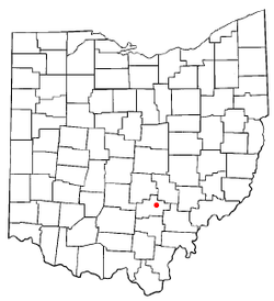
 Location of Logan, Ohio |
|
 Detailed map of Logan |
|
| Coordinates: 39°32′21″N 82°24′22″W / 39.53917°N 82.40611°WCoordinates: 39°32′21″N 82°24′22″W / 39.53917°N 82.40611°W | |
| Country | United States |
| State | Ohio |
| County | Hocking |
| Government | |
| • Mayor | Greg Fraunfelter |
| Area | |
| • Total | 4.93 sq mi (12.77 km2) |
| • Land | 4.79 sq mi (12.41 km2) |
| • Water | 0.14 sq mi (0.36 km2) |
| Elevation | 741 ft (226 m) |
| Population (2010) | |
| • Total | 7,152 |
| • Estimate (2012) | 7,157 |
| • Density | 1,493.1/sq mi (576.5/km2) |
| Time zone | Eastern (EST) (UTC-5) |
| • Summer (DST) | EDT (UTC-4) |
| ZIP code | 43138 |
| Area code(s) | 740 Exchanges: 380,385,823 |
| FIPS code | 39-44632 |
| GNIS feature ID | 1042716 |
| Website | http://www.loganohio.net/ |
Logan is a city in Hocking County, Ohio, United States. The population was 7,152 at the 2010 census. It is the county seat of Hocking County. Logan is located in southeast Ohio, on the Hocking River 48 miles southeast of Columbus. The current mayor of Logan is Republican Greg Fraunfelter, who began a four-year term in January 2016.
Logan is the county seat of Hocking County, Ohio. Residents named the town in honor of Chief Logan of the Mingo Indian tribe. He and his band lived in this area at the time of European-American settlement. Ohio Governor Thomas Worthington established the community in 1816.
According to the Ohio Historical Society, Logan had about 250 residents in 1825, and 600 by 1840. The Hocking River provided sufficient water power for the purpose of operating grist and sawmills, particularly at the falls above Logan. The town of Logan was slow to progress until the opening of the Hocking Canal, a branch of the Ohio and Erie Canal, in 1838. Several industries prospered due to the rich mineral resources of the Hocking Valley.
Logan was incorporated as a city in 1839.
The discovery of immense quantities of coal led to the flourishing mining industry. Towns appeared and vanished as quickly as mines opened and closed.
It was soon found that iron ore could be extracted from the sandstone bedrock of the area. At its height during the Civil War, Ohio was the leading producer of iron for implements and weapons. No less than forty-six furnaces were firing in southern Ohio's six-county Hanging Rock Iron Region. By summer 1865, up to sixty furnaces were counted.
The clay soils of the Hocking Valley helped Ohio become a leader in clay products. The firebrick industry of the valley manufactured such products as clay tile, building and paving bricks and clay sewer pipe. Evidence of the industry can be seen in the many brick houses and abandoned kilns of the area. Clay is still an important industry in the region.
...
Wikipedia
